My traverse in a nutshell
| Type: | Self-supported (no porters), high-altitude, multi-day hike |
| Location: | Mount Kenya |
| Start: | Met Station (3050 m) |
| Finish: | Sirimon Gate (2650 m) |
| Distance: | 55 km |
| Hiking time: | 27 hr 55 min (including stops) over 4 consecutive days |
| Elevation gain: | 3320 m |
| Elevation loss: | 3600 m |
| Elevation range: | 2650–4985 m |
| Average day: | 13.8 km, 6 hr 58 min, 830 m gain |
| Average pace: | 2.0 km/hr (30 min/km) |
| Backpack base weight: | 7.6 kg (excluding food and water) |
| Starting food weight: | 3.2 kg (no resupplies) |
| Difficulty: | Strenuous |
Traversing Mount Kenya
This was my second Mount Kenya traverse in as many months. I had originally planned a multi-day hike across the Aberdares, but the park ranger required for camping security cancelled at the last minute. With four hiking days already set aside, I decided to return to Mount Kenya instead.
My previous traverse – the one I called Four Base Camps – ran from Chogoria Gate to Sirimon Gate, following a long clockwise route around the central peaks and passing through all four summit base camps: Mintos, Austrian Hut, Mackinder’s Camp, and Shipton’s Camp. This time, I wanted a different experience focusing on three of the mountain’s major valleys: Teleki Valley, Gorges Valley, and Mackinder Valley.
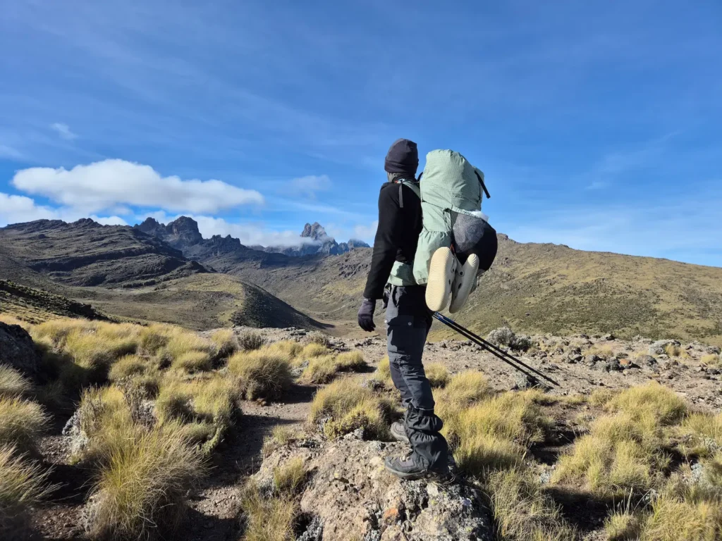
I began at the Met Station on the Naro Moru route, ascending through Teleki Valley on the western side of the mountain. On Day 2, I summited Point Lenana, the highest non-technical peak on Mount Kenya, which was also the most direct route to Gorges Valley on the east. I finished the four-day traverse at Sirimon Gate after descending through Mackinder Valley to the north.
As with the previous trip, I chose not to use porters. My gear and base weight were unchanged, but I carried slightly more food this time: 3.2 kg compared to 3 kg – a mistake in hindsight. I won’t repeat my packing list or meal plan here; those details are covered in the Four Base Camps article.
This traverse also included an unexpected emergency evacuation involving one of my guides. More on that later.
This article covers:
My four-day traverse across Mount Kenya
Here’s a brief account of how each day unfolded.
Day 1: Met Station to Mackinder’s Camp
Hike: 10 km, 5 hr 3 min, 1181 m gain, 38 m loss, 3050–4200 m
Difficulty: Strenuous
The first day of a multi-day hike is often demanding as the mind and body adjust to long hours on the trail. This one felt particularly tough. Of the three major approach routes – Chogoria, Naro Moru, and Sirimon – Naro Moru is the steepest.
The day involved almost 1200 m of elevation gain, finishing at 4200 m, which was a high altitude for the first day. Because it was the start of the traverse and I was carrying a full load of food, my backpack was at its heaviest at roughly 12.3 kg, including 1.5 L of water.
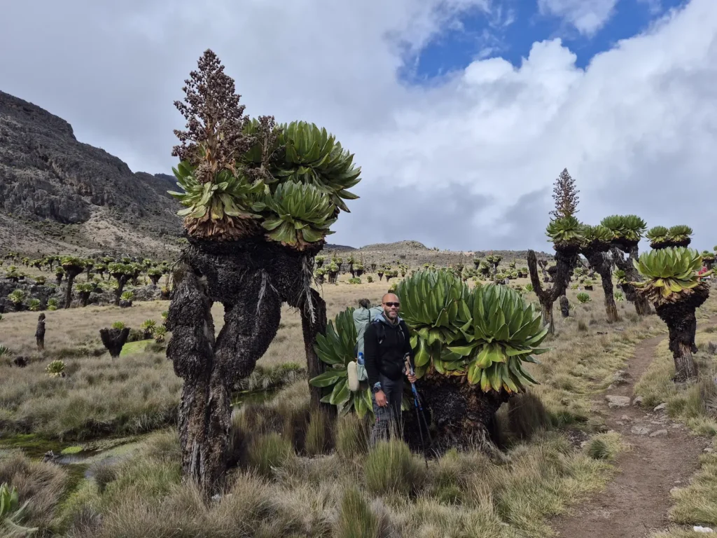
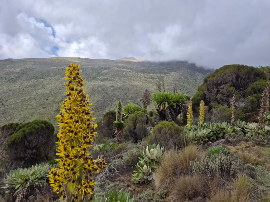
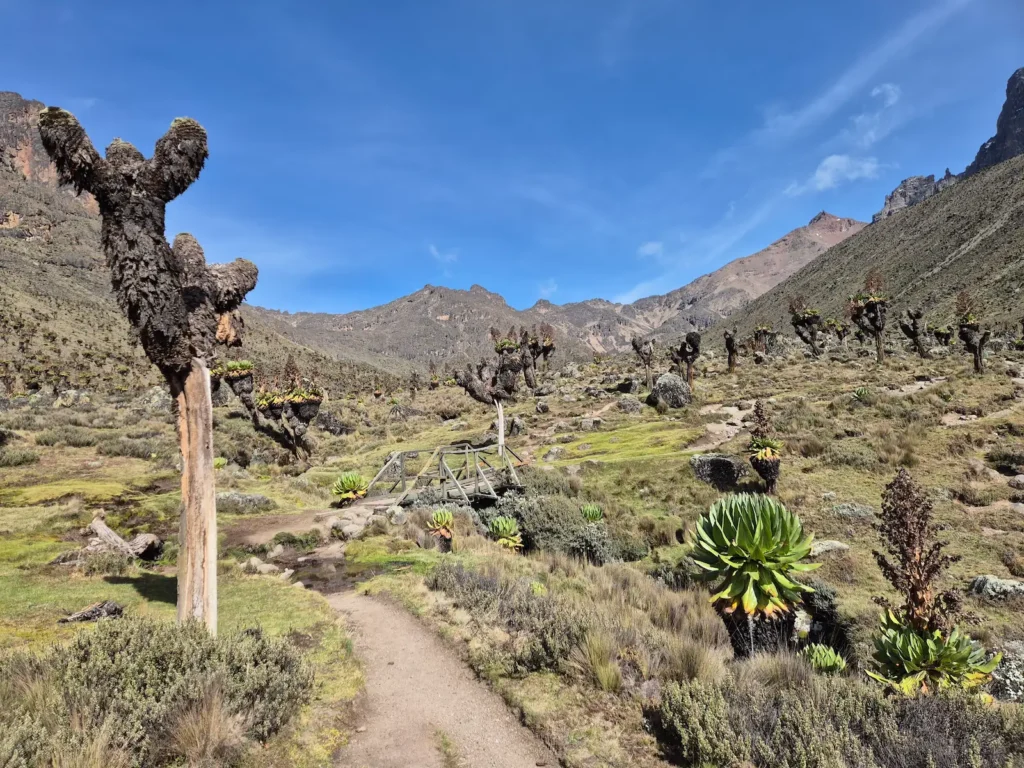
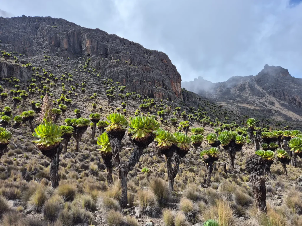
I started just before 1 PM, later than planned due to a delay with one of my guides arriving at the gate, and reached Mackinder’s (4200 m) at around 6 PM. It was a harder day than I had expected, but the afternoon was beautiful: blue skies, warm sunshine, Teleki Valley filled with giant groundsel and lobelia, and views of Mount Kenya’s peaks in the distance.
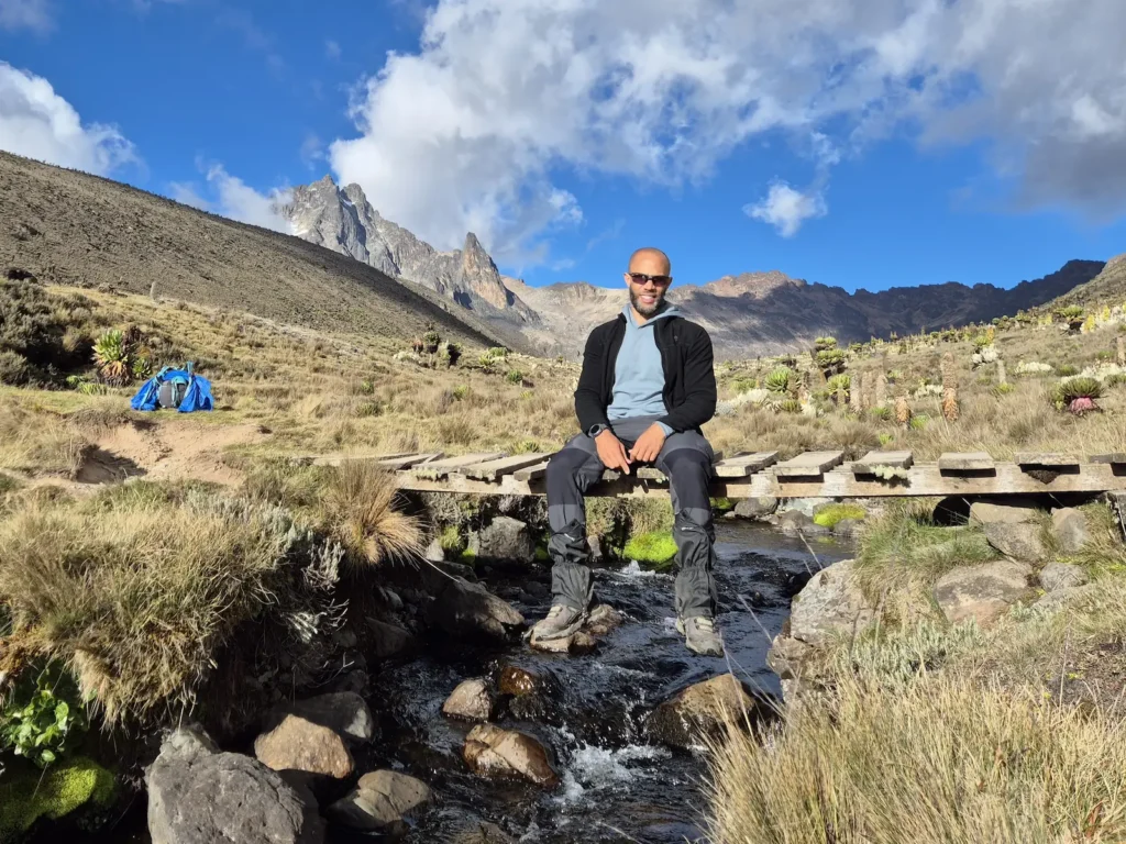
The clear skies also meant a cold night. Both guides chose to sleep inside the hut, while I camped outside and braved the temperature drop. My thermometer recorded a minimum overnight temperature of –2°C. My guides were wise to move indoors – but the next two nights would be just as cold, and with no huts at our planned rest spots, we would all be exposed.
Day 2: Mackinder’s Camp to Teleki Tarns, Point Lenana, and Lake Michaelson
Hike: 13.3 km, 9 hr 15 min, 1057 m gain, 1267 m loss, 3950–4985 m
Difficulty: Very strenuous
The temperature at high altitude rises quickly after sunrise, and this morning was no exception, jumping from below freezing to around 15°C by 8 AM. I was in no hurry for an early start, so I had a slow breakfast before packing up.
I began the day at 8:15 AM with a short 1.5 km walk to Teleki Tarns (4290 m). Covering just over 3.2 hectares (8 acres), it is the eighth-largest lake on Mount Kenya and the largest in Teleki Valley. It’s also stunning. For those staying at Mackinder’s, the 3 km round-trip – or 4 km if walking around the lake – is worthwhile.
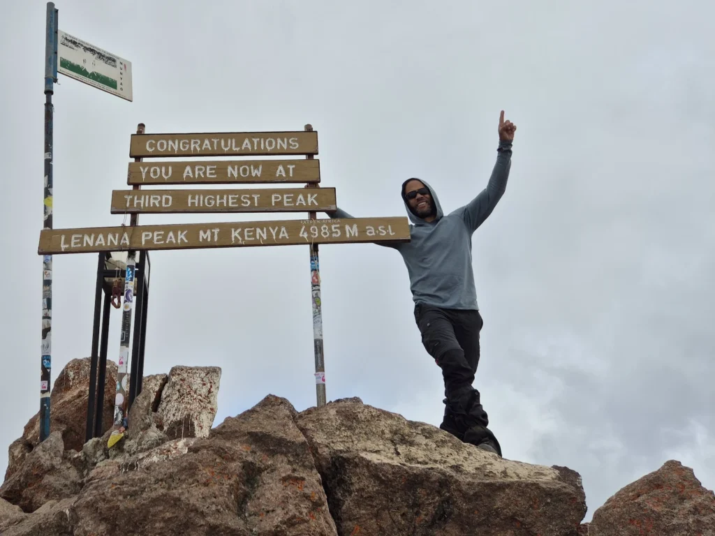
After circling Teleki Tarns, I returned to Mackinder’s to collect my backpack, refill my water, and prepare for the 785 m climb to Point Lenana. I set off at roughly 10:15 AM, stopped at Austrian Hut (4790 m) for a short lunch break, and summited Point Lenana (4985 m) at around 2 PM.
The rest of the day was entirely downhill. It took about two hours to cover the 4.1 km to Mintos (4280 m), passing Harris Tarn (4760 m) on the descent. Mintos is a popular campsite, but it is often very cold at night.
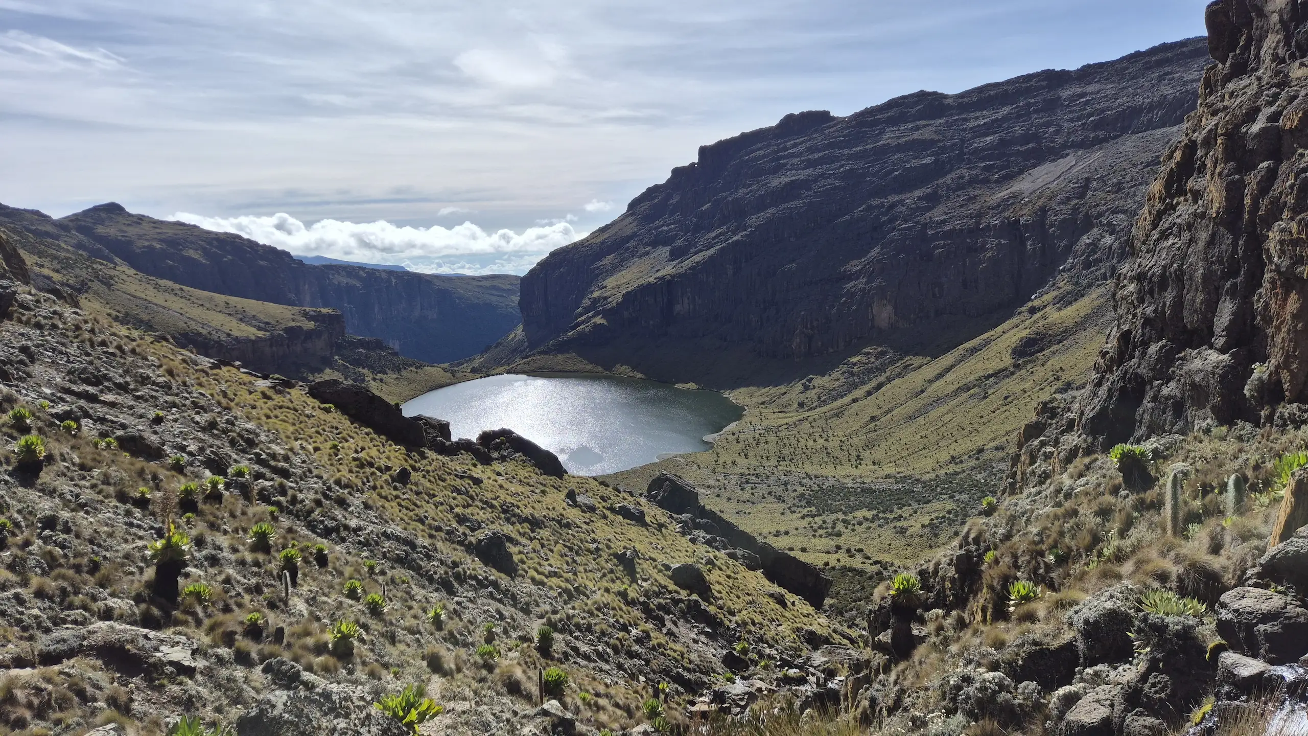
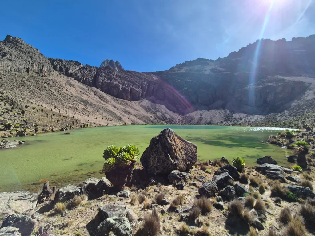
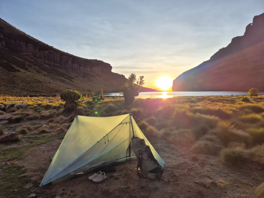
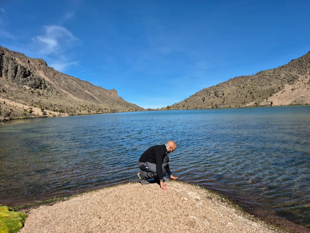
As it was still only 4 PM, I continued another 2.5 km down into Gorges Valley to camp at Lake Michaelson (3950 m). The final 1.2 km involved a steep 300 m drop past the Temple, a sheer cliff face overlooking the lake. I arrived at 5:30 PM with enough time to set up camp before the temperature fell.
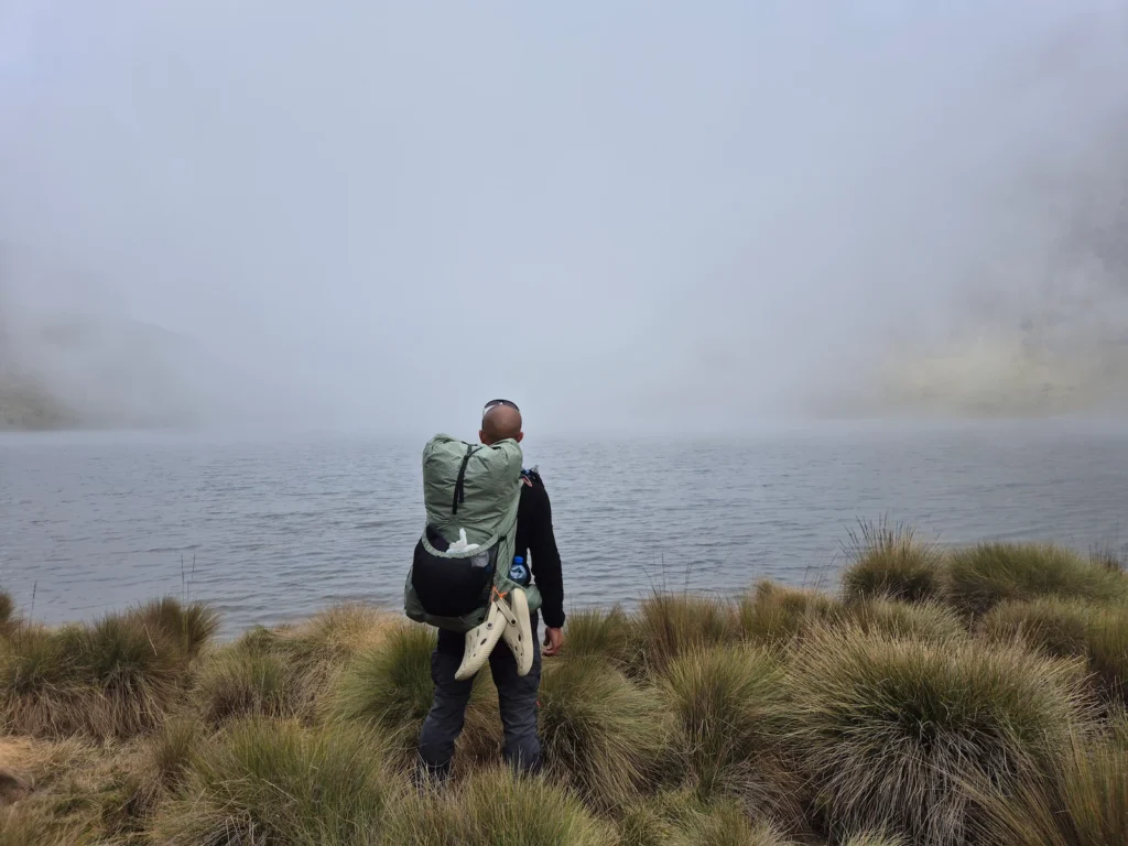
At roughly 12 hectares (30 acres), Lake Michaelson is the second-largest lake on Mount Kenya and the largest in Gorges Valley. It’s another spectacular sight, especially when the sun rises over the water between the valley walls. The view alone is reason to camp here. After a long day of climbing and descending, Lake Michaelson felt like the perfect place to stop.
Day 3: Lake Michaelson to Liki North
Hike: 16 km, 10 hr, 992 m gain, 955 m loss, 3950–4620 m
Difficulty: Very strenuous
This turned out to be the toughest day.
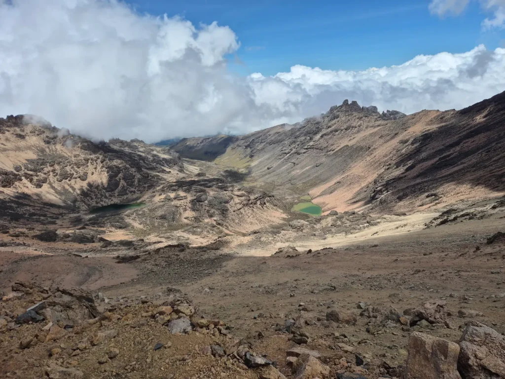
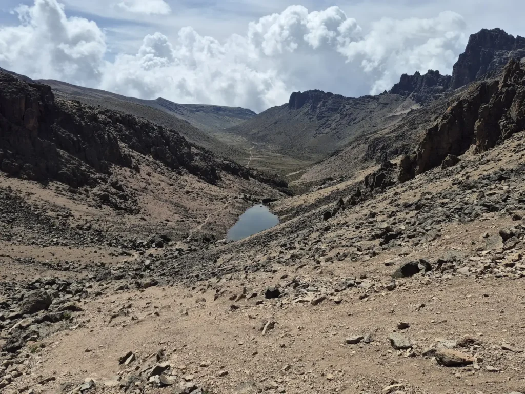
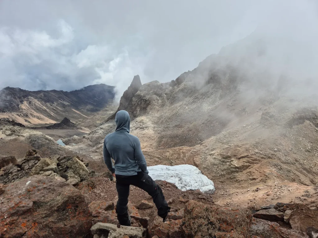
After another sub-zero night, I set off shortly after 8 AM once the temperature had risen to a more comfortable level. The plan was to climb out of Gorges Valley and continue to Simba Col (4620 m) – roughly 670 m of ascent over 3.3 km, with an average gradient of more than 20%.
Within 10 minutes, however, it was clear that one of my guides, Peter, was struggling. He had very low energy, was too weak to carry his backpack, and was deteriorating quickly. Something was seriously wrong, and it was obvious he wouldn’t be able to complete the day’s route. We later learned he had developed pneumonia and his blood oxygen level was dangerously low.
Reaching the nearest rangers’ camp would have required gaining even more altitude, and the closest access road was at least 8 km away. Neither was a viable option, so the safest course was to call rescue services and request an evacuation.
I hiked ahead to the rim of the valley until I reached a point with mobile reception. After describing Peter’s symptoms and our location, rescue services dispatched a helicopter to meet us at Mintos. When Peter and the second guide caught up with me (I had stayed put to maintain contact), we continued east for around 1.5 km to Mintos – fortunately with no further elevation gain.
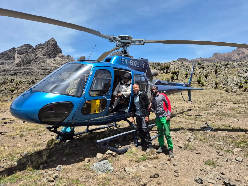
The helicopter arrived within minutes of us reaching Mintos. It took rescue.co, the rescue service, less than an hour from my first phone call – an impressively quick response. Peter was flown to a hospital in Nanyuki and was fortunately discharged later that evening. It had been a stressful morning, but I was grateful he was now safe and receiving proper care.
It was 12:20 PM, and the hiking day was effectively starting now. My legs were already cooked: I had carried both my backpack and Peter’s most of the way up the valley and all the way to Mintos – around 20 kg over 3 km at more than 4000 m. Tonight’s campsite was still 12 km away with plenty of climbing ahead. It was time to start moving.
I retraced my steps west along the Chogoria route before leaving the summit path at Simba Tarn (4600 m) and beginning the long descent to Lower Simba Tarn (4400 m) and Shipton’s (4260 m). From there, I continued along the Sirimon route through Mackinder Valley before turning off at the Liki North junction.
The day ended with a strenuous 200 m climb and descent over the valley wall to reach Liki North (3990 m). It was the last thing I needed after such a long day. I arrived shortly after 6 PM, exhausted.
Day 4: Liki North to Sirimon Gate
Hike: 16 km, 3 hr 37 min, 92 m gain, 1343 m loss, 2650–4070 m
Difficulty: Moderate
The final day began at 7:45 AM with a short climb out of the valley, followed by several kilometres of open moorland with views stretching to the horizon and Mount Kenya’s peaks behind.
I reached Old Moses (3390 m) two hours after setting off, passing the first group of hikers I had seen in four days. I continued without stopping for just over an hour and a half on the final downhill stretch to Sirimon Gate (2650 m).
After the intensity of the previous day, it was a relief to finish the traverse with a straightforward and uneventful descent.
Lessons from the emergency evacuation
Hiking in the mountains can be unforgiving, especially at high altitude. I always carry a comprehensive first aid kit, including an emergency blanket, but this experience made me think more carefully about communication protocols.
Setting aside solo expeditions in remote areas – where a two‑way satellite communicator is essential – it is worth considering how communication works on guided trips such as those on Mount Kenya, where groups are often accompanied by several guides and porters.
Mobile reception on Mount Kenya is patchy. In large groups, there is usually enough redundancy for one or two experienced guides to separate from the group, find a signal, and call for help while the rest remain safely supervised. If the nearest reception point is an hour or two away, this can be a workable plan.
In small groups, the situation is differenet. I prefer to hike with one or two guides, in which case the redundancy simply isn’t there. I was fortunate on this traverse: when the emergency began, I was less than an hour from mobile reception. In another part of the mountain, the delay could have been much longer, and the outcome very different.
This experience clarified something important: carrying a two‑way satellite messenger is almost always essential, regardless of group size, but especially for small groups. It removes uncertainty from the most time‑critical part of an emergency: getting a message out.
Hikers should also ensure they have rescue insurance. Peter did.
Which traverse was tougher: Four Base Camps or Three Valleys
In short, the Three Valleys traverse was more challenging.
Both routes took four days, covered over 50 km, and were strenuous, but several factors made the Three Valleys traverse harder:
- Higher average daily elevation gain: 830 m vs 720 m
- Higher average elevation: 4170 m vs 4050 m
- Higher peak elevation: 4985 m vs 4790 m
- More time spent above 4000 m
- Longer average hiking day: 6 hr 58 min vs 5 hr 50 min
- Longer average daily distance: 13.8 km vs 13.2 km
- Steeper average gradient: 6% vs 5.5%
- Heavier backpack weight: 10.8 kg vs 10.6 kg
- An emergency evacuation, which added physical and mental strain
Although I enjoyed four days of sunshine and blue skies, compared to four days of cold rain on the Four Base Camps traverse, these factors made the Three Valleys route the more demanding of the two.
Final thoughts on the traverse
Mount Kenya continues to surprise me. This traverse explored three of its main valleys – Teleki, Gorges, and Mackinder – and revealed some of the mountain’s most dramatic scenery: open moorland and steep valley walls, scree slopes and boulder fields, tarns and glaciers, and rocky central spires. Watching the sun rise over Lake Michaelson from the warmth of my tent was a highlight.
The trek was challenging, particularly the sustained time at altitude, long days, and steep climbs. The emergency evacuation added an unexpected layer of physical and mental strain, but it also highlighted the importance of preparation, communication, and good decision‑making in the mountains.
If you enjoy multi‑day hikes and want to experience the diversity of Mount Kenya, either traverse offers a memorable way to explore some of its most striking landscapes.