This daily hiking log is part of an eight-day series following my wife and me on a 140 km hike through Tuscany. You can find the full story and logs for the other days on the Tuscany page.
My day in a nutshell
| Start: | San Gimignano |
| Finish: | Colle di Val d’Elsa |
| Distance: | 13.0 km |
| Hiking time: | 5 hr 59 min (including stops) |
| Elevation gain: | 282 m |
| Elevation loss: | 425 m |
| Elevation range: | 142–336 m |
| Difficulty: | Moderate |
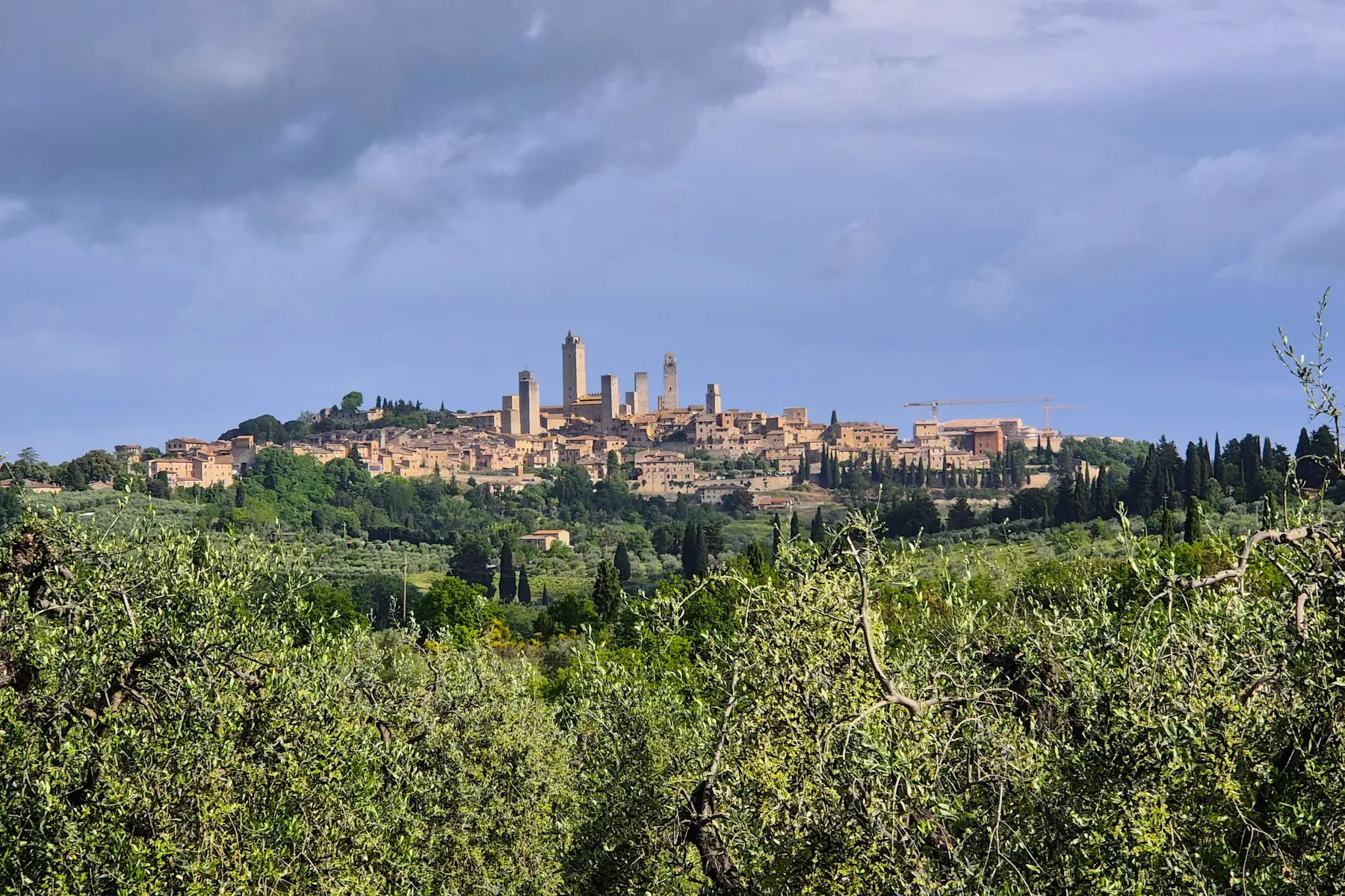
Starting our journey in San Gimignano
We arrived in San Gimignano the day before setting off on our eight-day hike. With no distance to cover and a free afternoon, we wandered through the medieval streets of its UNESCO-listed centre.
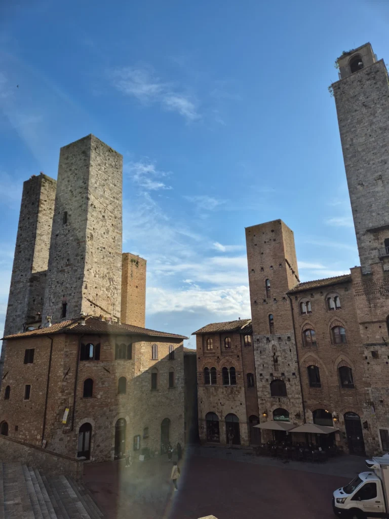
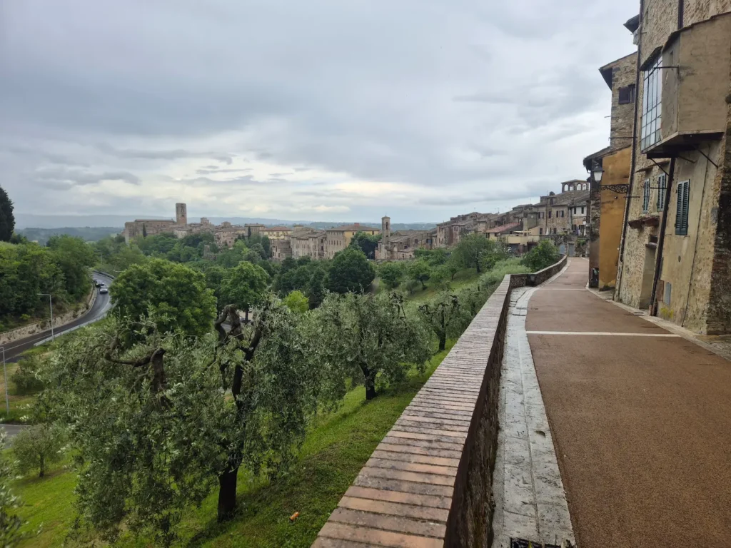
San Gimignano is one of Italy’s best-preserved medieval towns. While its origns reach back to the 3rd century BC, this walled hilltop settlement truly flourished during the Middle Ages, when rival families built soaring stone tower houses – some rising nearly 50 metres – as displays of wealth and power. At its peak, San Gimignano had 72 towers; 14 remain today, giving the skyline its distinctive profile and earning the town the nickname “the Manhattan of the Middle Ages”.
The first day on the trail
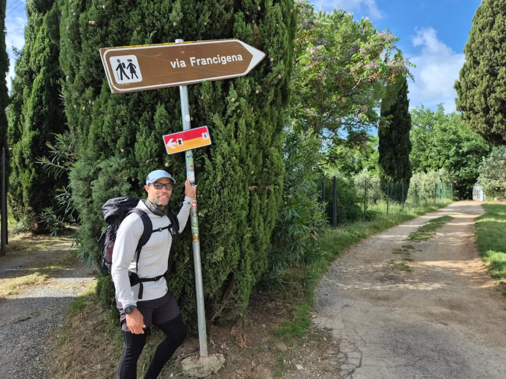
We left our guesthouse around 7:30 AM, walking roughly 1 km to San Gimignano’s centre to mark our official starting point and take a few photos before the tourist crowds arrived.
The plan for the first few days was to follow the Via Francigena – an ancient pilgrim route, similar to the Camino de Santiago, that stretches 3,200 km from Canterbury, England, to Rome, Italy. This simplified our navigation, as the Via Francigena is well signposted. Today’s route followed the first half of Stage 91.
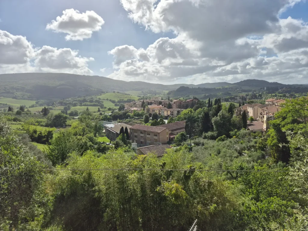
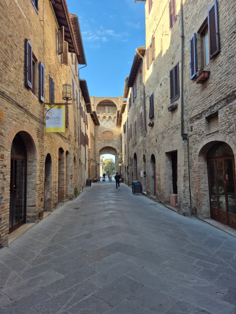
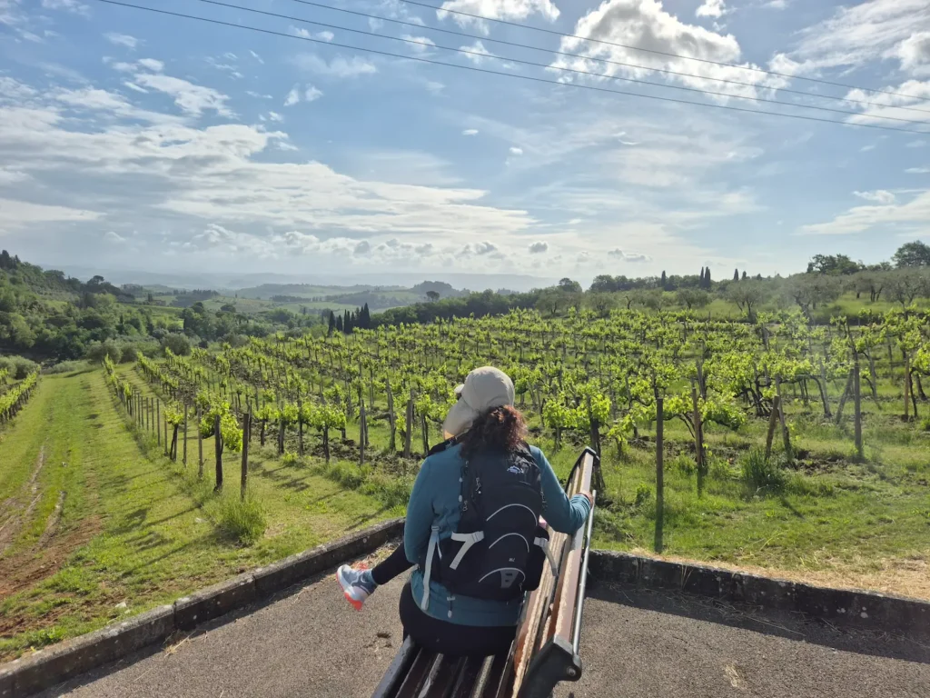
We left San Gimignano through Porta San Giovanni, an imposing 13th-century gate on the southern side. We descended along a tarmac road, walking beside olive trees and grapevines that would become defining features of our landscapes over the next eight days. I often turn around to absorb the views behind me while hiking, and San Gimignano offered a stunning skyline that fully lives up to its nickname.
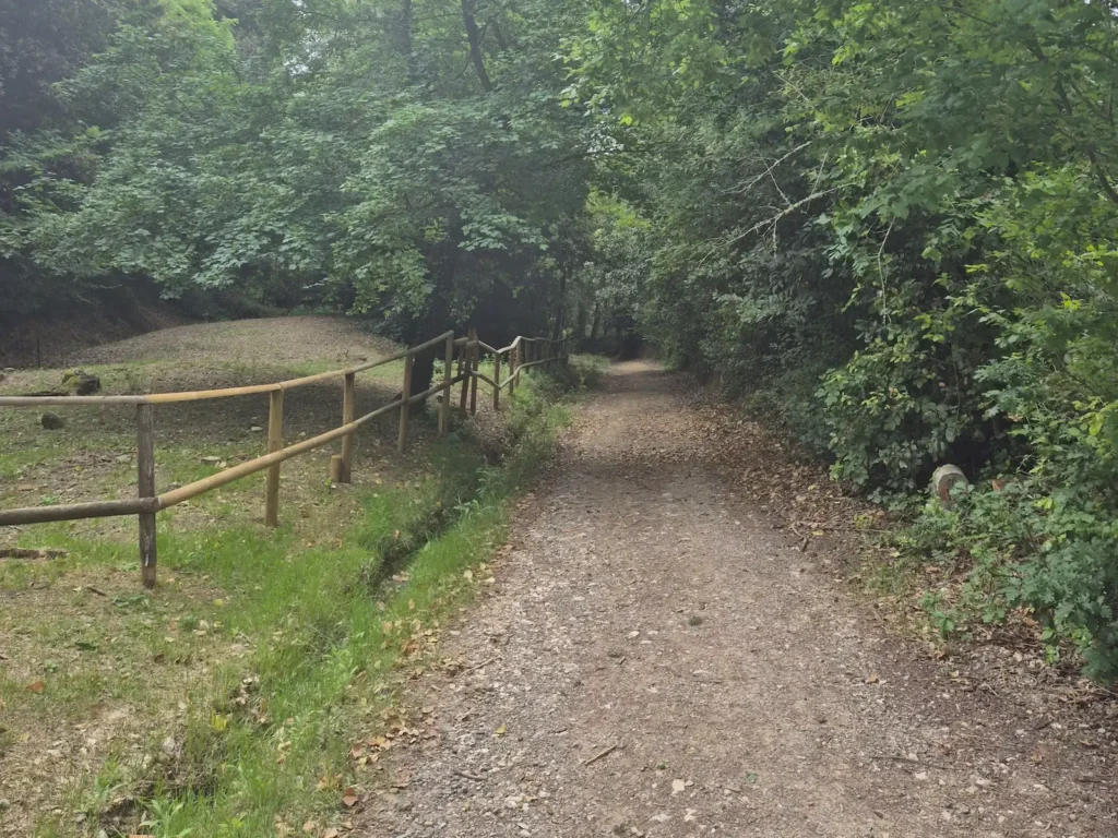
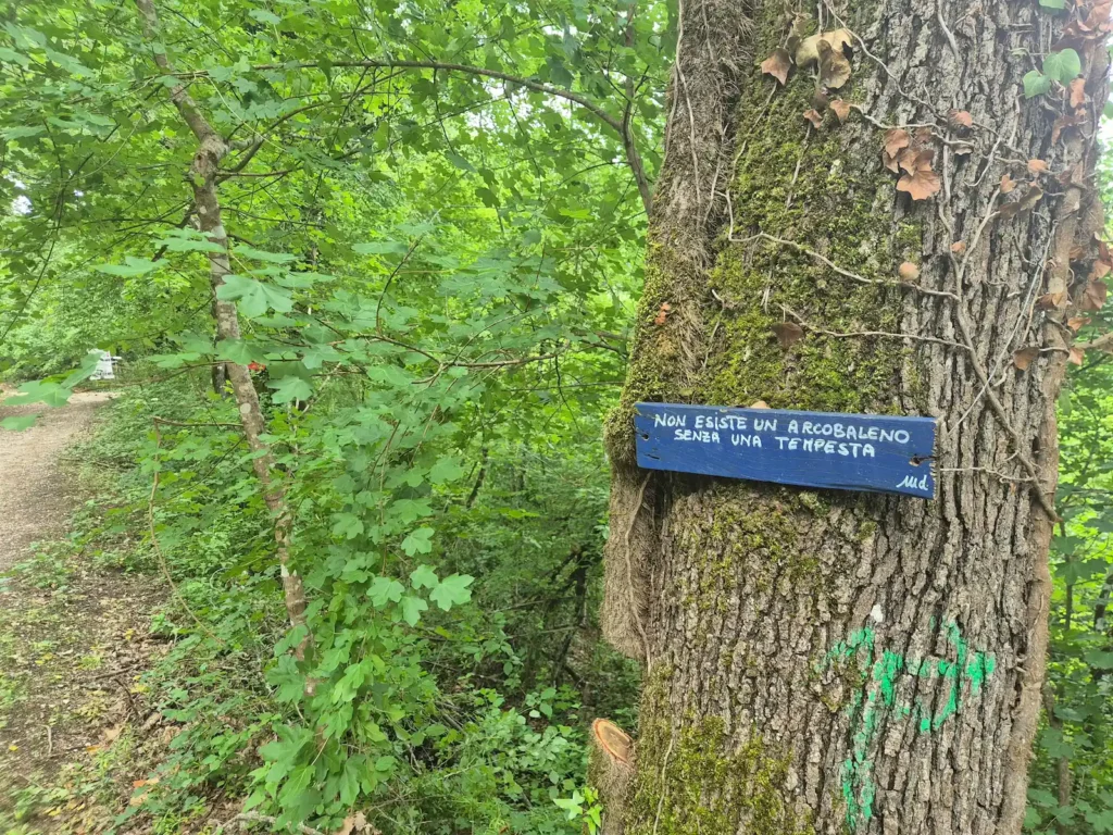
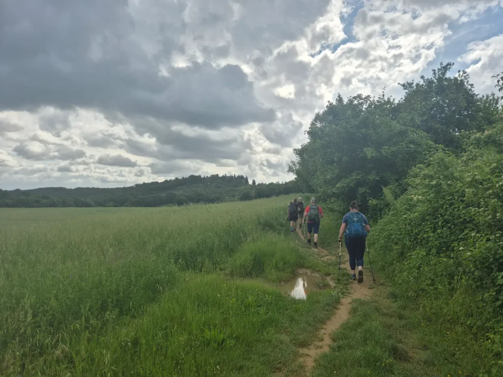
After a few kilometres, we turned off the main road onto a gravel path in a forest, crossing a few streams over the next hour. Along the way, we passed several trees adorned with colourful boards featuring motivational quotes in Italian. My favourite was: “Pensa a come potrebbe essere la tua vita se avessi fiducia in te stesso/a,” which translates to “Think about what your life could be like if you had faith in yourself.”
After roughly 7.5 km, the Via Francigena splits into two variants that both lead to Monteriggioni, our destination for the following day. The longer, traditional route via Quartaia branches to the right, while the shorter route via Colle di Val d’Elsa – our stop for today – is on the left. Most pilgrim hikers take the shorter option and spend the night in Colle di Val d’Elsa, completing Stage 91 over two days.
We returned to a tarmac road for the final few kilometres of the day, just as heavy rain began to fall. Judging that wind wouldn’t be a significant issue on our trip, I opted to carry umbrellas – something that proved useful not only in the rain but also later in the week under the blazing sun in exposed fields.
Arriving at Colle di Val d’Elsa
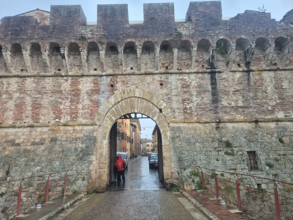
We reached Colle di Val d’Elsa through Porta Nuova, a large gate on the west side of town. Immediately past the gate was Portanova Hosteria Enoteca, a Tuscan restaurant where we lingered over a three-course lunch while waiting out the rain. Once the weather cleared, we set off on the final kilometre of the day, checking into our next guesthouse shortly after 3 PM.
Our first day offered plenty of variety: grassland, olive groves, vineyards, forests, stream crossings, sun, rain, and an undulating trail with wide views. I caught my first glimpse of red poppies, which reminded me of walking the Camino at a similar time the previous year. It was also good to see pilgrim hikers again.
Despite the variety, the route was sparse on amenities: no cafés or restaurants and only a handful of benches – a reality we would encounter repeatedly for the rest of the trip.
About Colle di Val d’Elsa
Colle di Val d’Elsa is a hill town stretched along the ridge above the Elsa Valley. Its position on the Via Francigena made it an important stop for pilgrims, merchants, and armies. For centuries, this corridor was a contested stronghold between two warring powers: Florence to the north and Siena to the south.
One of its defining landmarks is Porta Nuova, a defensive gate built in the 15th century after the town endured a siege in 1479. Today, Colle is best known as Italy’s capital of crystal production, where centuries of craftsmanship sit alongside its well-preserved medieval heritage.