My summit in a nutshell
| Type: | High-altitude, multi-day summit hike |
| Location: | Mount Kenya |
| Route: | Chogoria |
| Start/Finish: | Meru Bandas, Chogoria Gate (2980 m) |
| Distance: | 45 km |
| Duration: | 4 days / 3 nights |
| Elevation gain: | 2490 m |
| Elevation range: | 2950–4985 m |
| Summit day: | 17.7 km, 10–11 hr, 830 m gain, 1656 m loss |
| Difficulty: | Strenuous |
Climbing Mount Kenya
In early 2025, I was undertaking a series of moderately high-altitude day hikes with Outdoorer, a hiking community in Kenya, as preparation for Kilimanjaro later that year. When I checked their events calendar, one trip stood out: a four-day Mount Kenya hike with the summit day falling on my birthday.
The timing was ideal. It was two weeks before Kilimanjaro, giving me useful altitude exposure while still leaving enough recovery time. I had always planned to climb Mount Kenya, and this felt like the right moment. I signed up straight away.
Mount Kenya attracts approximately 15,000 visitors each year. Although not as popular as Kilimanjaro, which sees over 50,000 annual visitors, plenty of hiking groups and tour operators offer summit hikes ranging from three to five days or more. As with Kilimanjaro, there is ample information online for planning a hike. My aim here is to share key trip essentials and a few of my experiences to help anyone preparing for a summit attempt.
This article covers:
About Mount Kenya
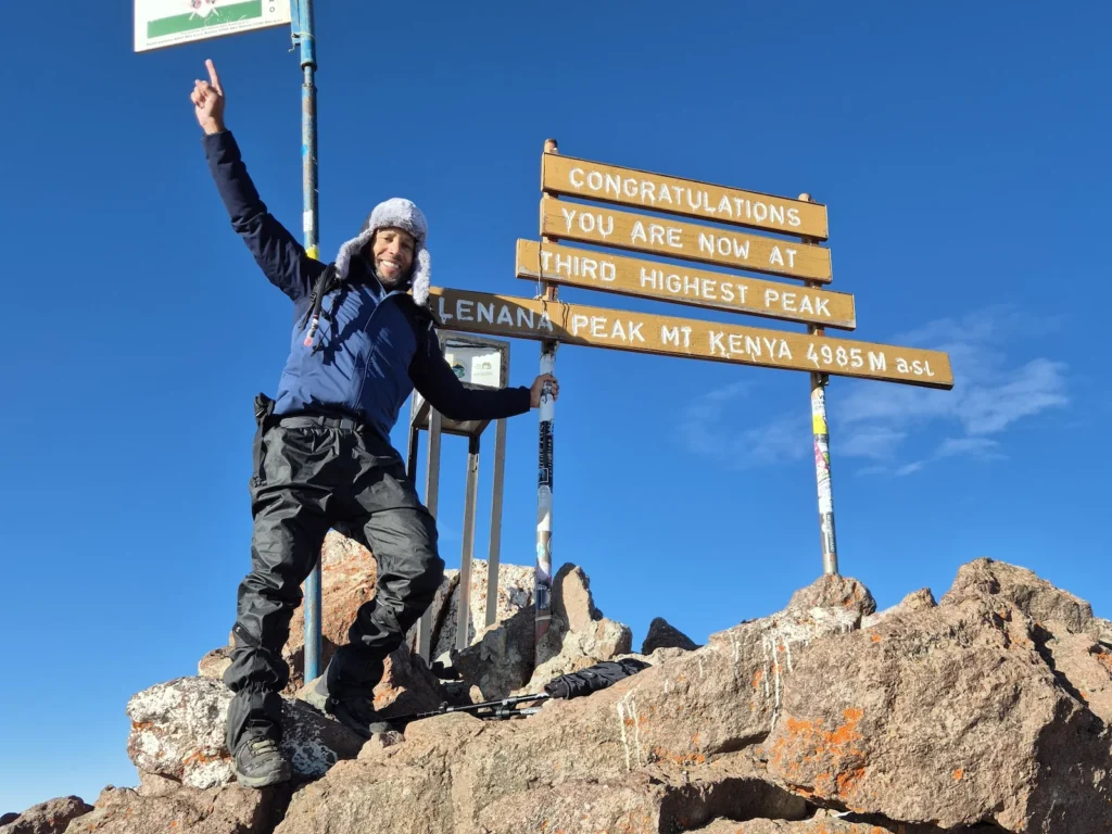
Mount Kenya is Africa’s second-highest mountain after Kilimanjaro. It is a rugged, ancient stratovolcano with three main peaks rising from its rocky central massif: Batian (5199 m), Nelion (5188 m), and Point Lenana (4985 m). Batian and Nelion are both technical ascents, while Point Lenana is the highest trekking summit and the objective of most hikers.
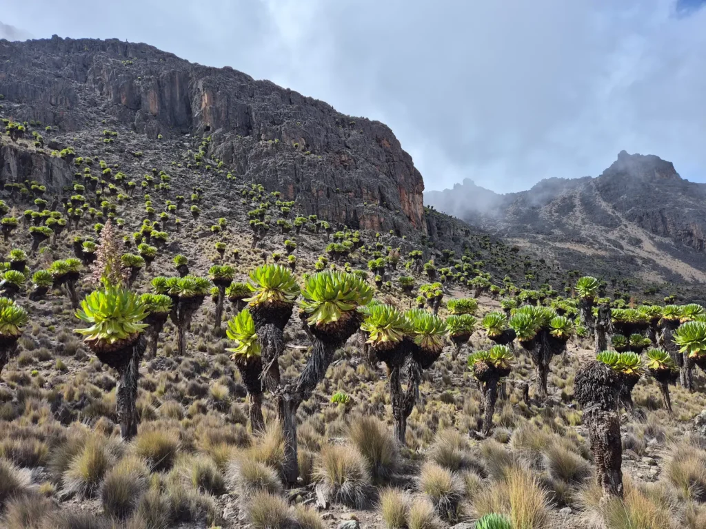
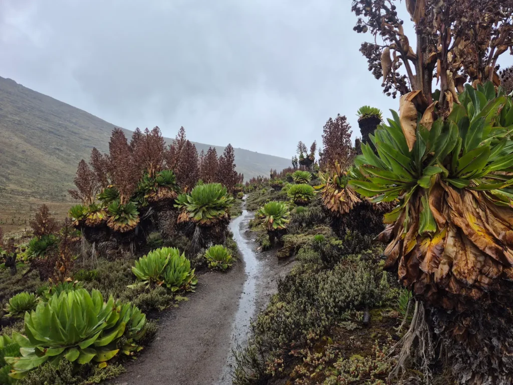
What sets Mount Kenya apart is its remarkable ecological diversity. The lower slopes begin in dense montane forest before giving way to bamboo and, higher up, to open moorland dotted with towering groundsel and giant lobelia – plants found in very few places on Earth. Beyond the moorland, the landscape becomes rocky and glaciated, with tarns, valleys, and ridgelines shaped by ancient ice.
It is a mountain of contrasts: lush and green at the base, wild and alpine near the top, with varied terrain in between.
Summit routes to Point Lenana
Most hikers reach Point Lenana via one of three routes: Chogoria, Naro Moru, or Sirimon. Each offers a different approach, landscape, and ascent profile.
Chogoria
Often described as the most scenic approach, Chogoria is known for its dramatic landscapes. The route passes Lake Ellis, crosses open moorland, and follows the rim of Gorges Valley. It continues to Mintos, the summit base camp for this route, with views of Lake Michaelson on a clear day. It is the longest of the three routes, but also the most gradual, making it well suited to acclimatisation.
Pros:
- The most varied and striking scenery
- Gradual ascent profile
- Fewer hikers than Sirimon and Naro Moru
Cons:
- Longer distances
- Road access can be difficult in the rainy season
Naro Moru
The shortest and steepest of the three routes, Naro Moru is often chosen by hikers aiming for a quick ascent. It is known for the “Vertical Bog” – a notoriously muddy section. The trail passes Met Station and continues along Teleki Valley before reaching Mackinder’s Camp, the summit base camp for this route.
Pros:
- Fastest route to the summit
- Suitable for strong hikers with limited time
Cons:
- Steep, muddy, and eroded in places
- Poor acclimatisation profile
Sirimon
Sirimon is the most popular route. It climbs steadily through forest and moorland, passing Old Moses and continuing along Mackinder Valley before reaching Shipton’s Camp, the summit base camp for this route.
Pros:
- Reliable access year-round
- Generally good trail conditions
Cons:
- Less dramatic scenery than Chogoria
- Can feel busy during peak season
My four-day summit hike via Chogoria
I joined a four-day summit trip on the Chogoria route with a group of about forty hikers. Four days is enough time to enjoy the mountain: two and a half days to reach the summit and one and a half days to descend back to the exit. I also had time on the final day for a short detour to Nithi Falls.
Here’s a brief account of each day.
Day 1: Chogoria Gate to Lake Ellis
Hike: 7.7 km, 2 hr 47 min, 537 m gain, 85 m loss, 2950–3470 m
Difficulty: Moderate to Difficult
I began the hike shortly after 4 PM. The first day followed a jeep track through forest and moorland. While the trail itself is fairly unremarkable, the goal was acclimatisation: move slowly and let your body adjust to the altitude.
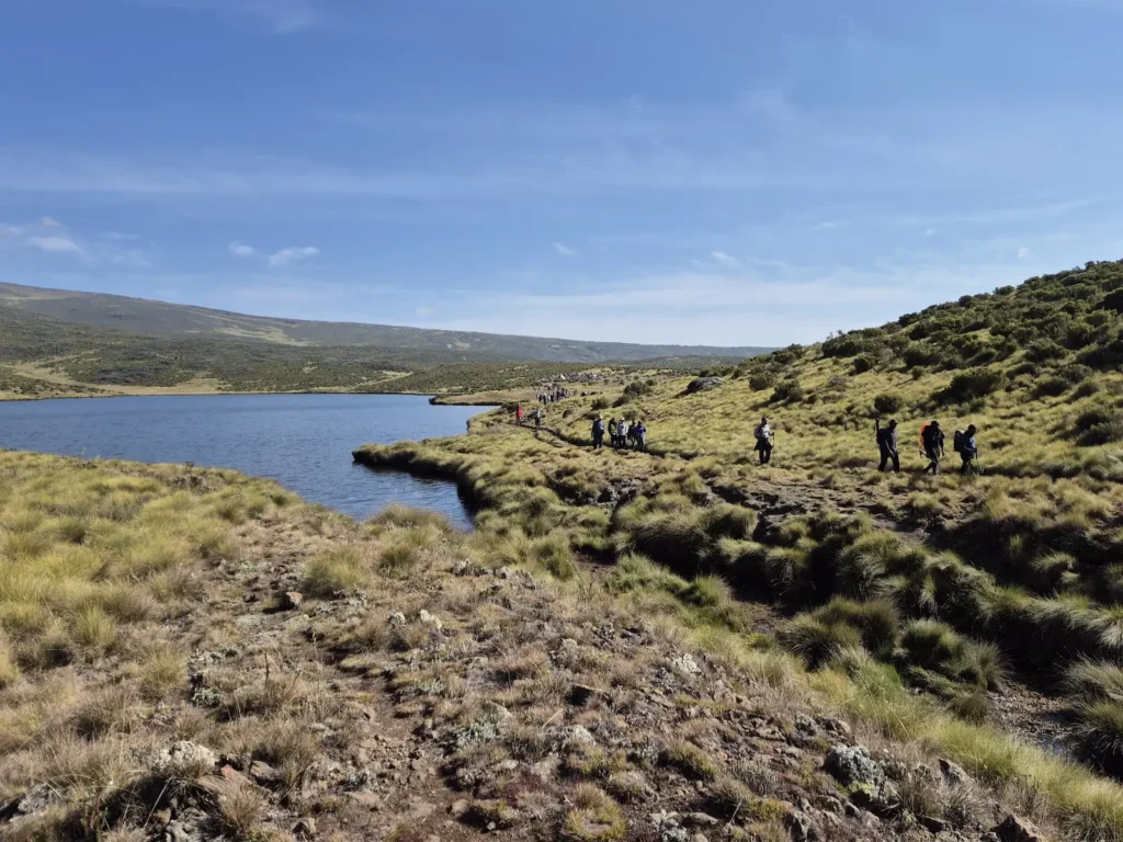
Lake Ellis (3470 m) sits in a wide, open basin with views of Mount Kenya’s peaks on a clear day. As the sun set, the temperature dropped quickly to below freezing – a reminder of how fast conditions change on the mountain.
Day 2: Lake Ellis to Mintos
Hike: 8.1 km, 6 hr 17 min, 937 m gain, 111 m loss, 3440–4300 m
Difficulty: Strenuous
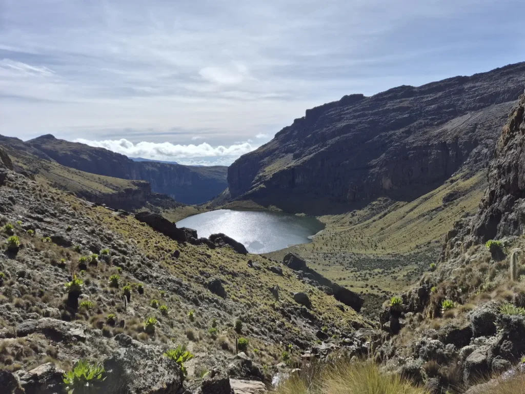
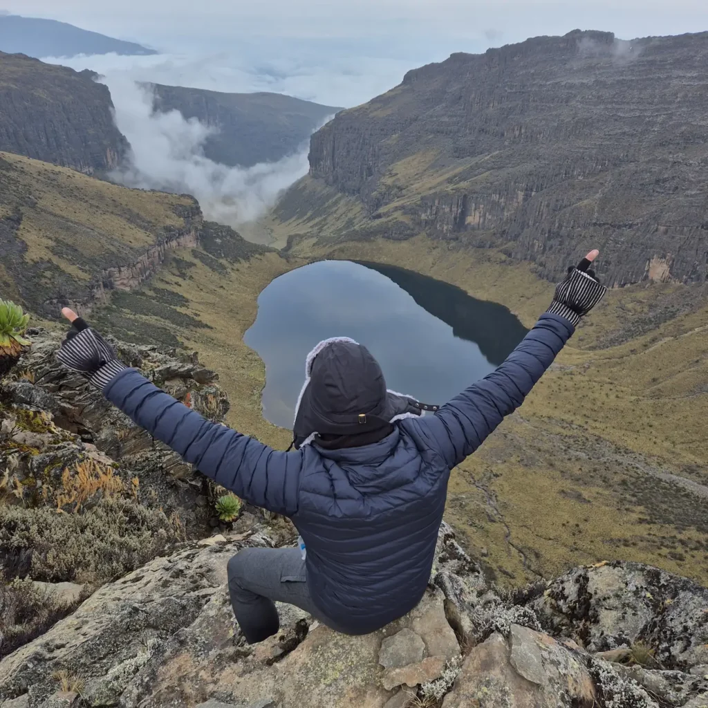
After breakfast and packing my daypack, I set off around 9 AM. The trail skirted Lake Ellis before a short descent to cross Nithi North River. From there, it climbed gradually to 4300 m, offering wide views of Gorges Valley and Lake Michaelson – one of the most beautiful tarns on Mount Kenya and a highlight of the Chogoria route.
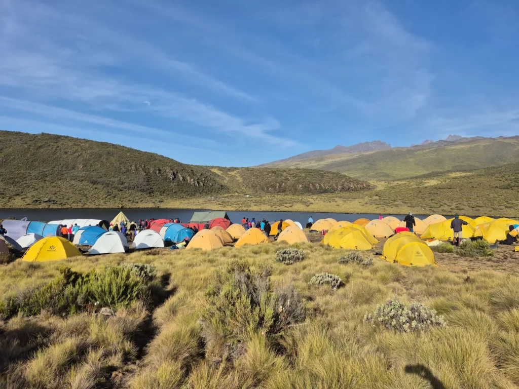
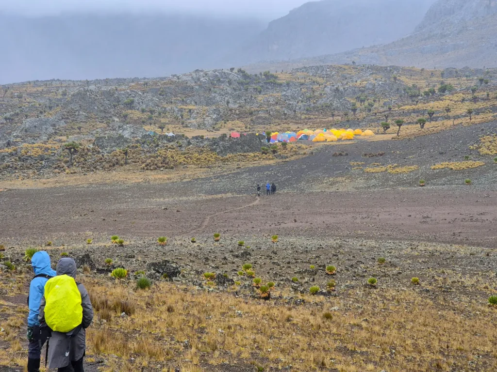
After arriving at Mintos (4280 m) and settling into camp, I took a short walk to Hall Tarns for another panoramic view of the valley. The rest of the day was for rest and recovery. Summit attempts begin in the early hours of the morning, and conserving energy is essential.
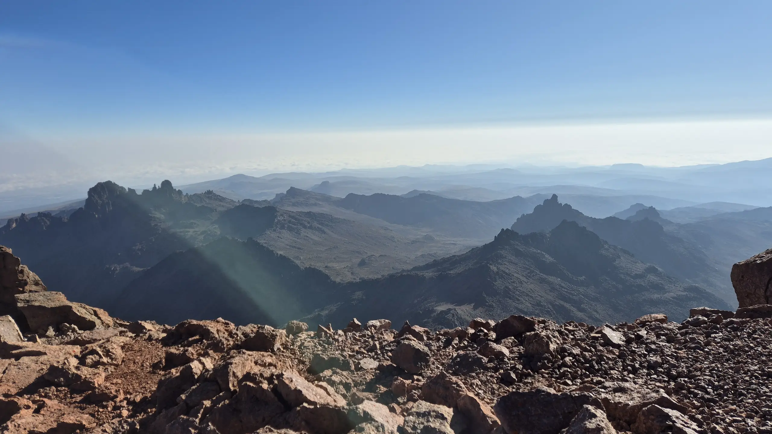
Day 3: Summit Day – Mintos to Point Lenana and Lake Ellis
Hike: 17.7 km, 10–11 hr, 830 m gain, 1656 m loss, 3440–4985 m
Difficulty: Very strenuous
I woke up around 1 AM to prepare for the summit push and started hiking shortly after 2:30 AM. The bitter cold, lack of sleep, and high altitude turn a moderately difficult 4.8 km trail with 712 m of elevation gain into a strenuous five-hour effort. But it was worth it – the views from Point Lenana (4985 m) are spectacular and the sense of achievement significant.
After spending about 20 minutes at the summit to take photos, I began the 12.9 km descent, stopping at Mintos for brunch before continuing to Lake Ellis for the night.
Day 4: Lake Ellis to Chogoria Gate via Nithi Falls
Hike: 11.7 km, 3 hr 15 min, 186 m gain, 658 m loss, 2950–3470 m
Difficulty: Moderate
The final day was a steady walk out of the park, passing Nithi Falls, another highlight of the Chogoria route, on the way to the gate.
Final thoughts on climbing Mount Kenya
Summiting Mount Kenya via Chogoria is an excellent way to experience the mountain. The route is scenic, gradual, and varied, with lakes, valleys, cliffs, and high ridges. While the summit push is demanding, it remains accessible to most hikers with good fitness, proper preparation, and a steady pace.
If you’re looking for a memorable way to reach Point Lenana, the Chogoria route is hard to beat.