This daily hiking log is part of an eight-day series following my wife and me on a 140 km hike through Tuscany. You can find the full story and logs for the other days on the Tuscany page.
My day in a nutshell
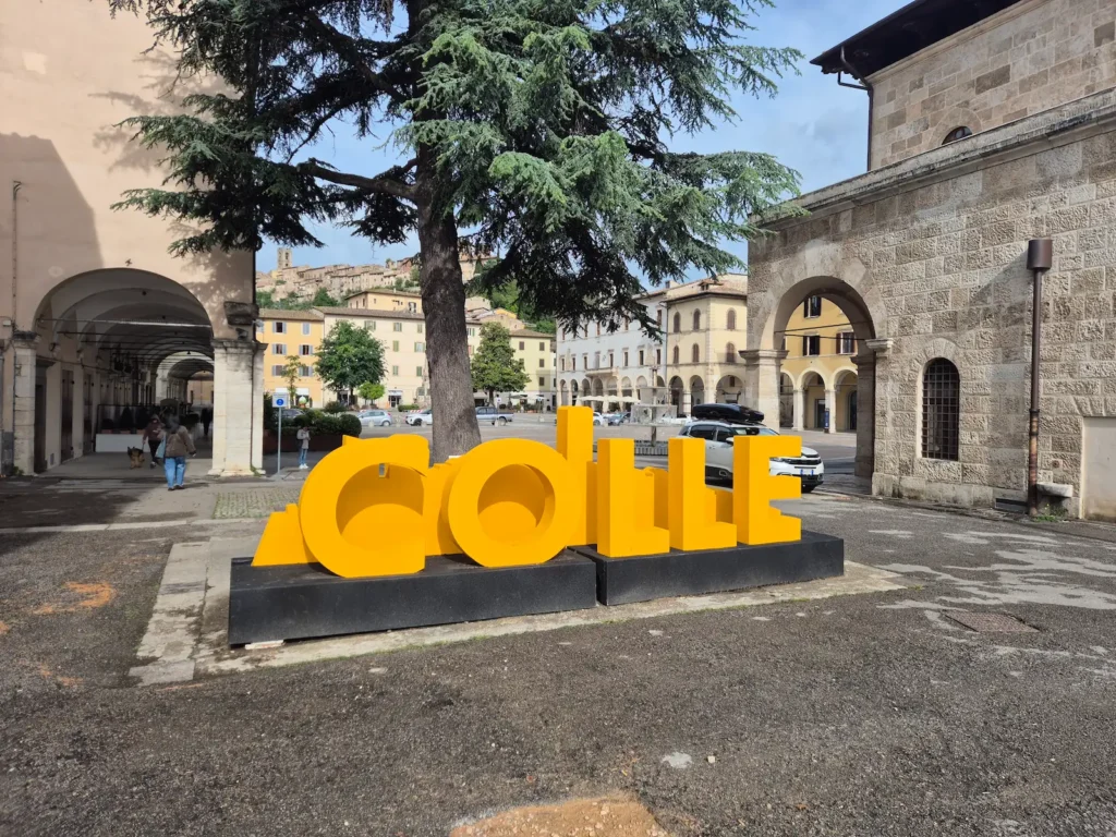
| Start: | Colle di Val d’Elsa |
| Finish: | Monteriggioni |
| Distance: | 18.9 km |
| Hiking time: | 6 hr 50 min (including stops) |
| Elevation gain: | 418 m |
| Elevation loss: | 350 m |
| Elevation range: | 107–270 m |
| Difficulty: | Difficult |
Leaving Colle di Val d’Elsa
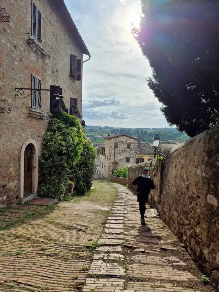
We packed our bags and set off at 8:20 AM, walking through the old town before descending steeply on a grassy stone path towards Colle’s main commercial centre. The morning was chilly but sunny, around 12°C, and after the previous day’s downpour, we were glad no rain was forecast.
After a quick stop at a café and an ATM, we rejoined the Via Francigena for our second day, continuing on from yesterday’s Stage 91.
Shortly after the 2 km mark, we entered the Upper Val d’Elsa River Park, a protected, lush green corridor that follows the River Elsa. This area is home to the Sentierelsa Trail, a 4 km riverside path running through a shaded gorge. The trail features natural pools, small waterfalls, travertine shelves, wooden footbridges, scenic viewpoints, and several river crossings. The river is also suitable for swimming, though not on a cool morning such as this.
Our route joined the Sentierelsa for its final 2.5 km. The first river crossing was the most precarious: a narrow, rocky channel with fast‑flowing water, and no way to keep our shoes dry. It wasn’t the ideal start to the day. To our relief, the next two crossings were gentler and far less dramatic.
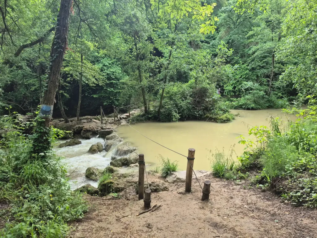
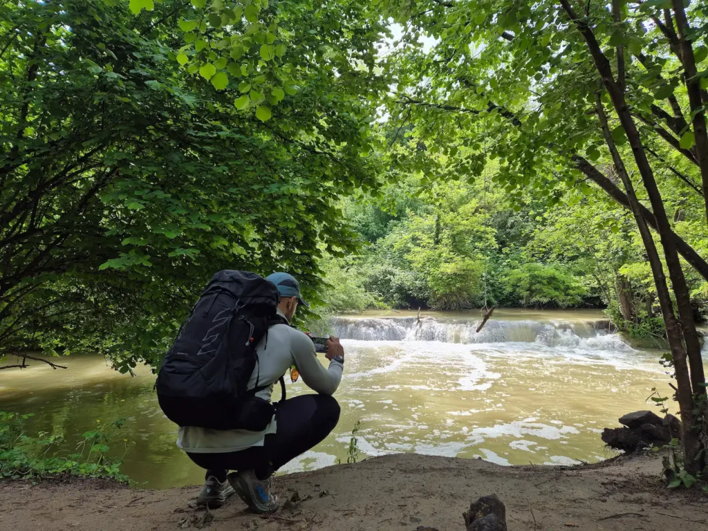
Despite our wet footwear, walking along the Sentierelsa was enjoyable and a refreshing way to begin the day. At the end of the path, we climbed a staircase to the main road, continued for another 10 minutes, and stopped in the village of Gracciano dell’Elsa for a light snack and our second coffee of the morning.
Gracciano dell’Elsa to Monteriggioni
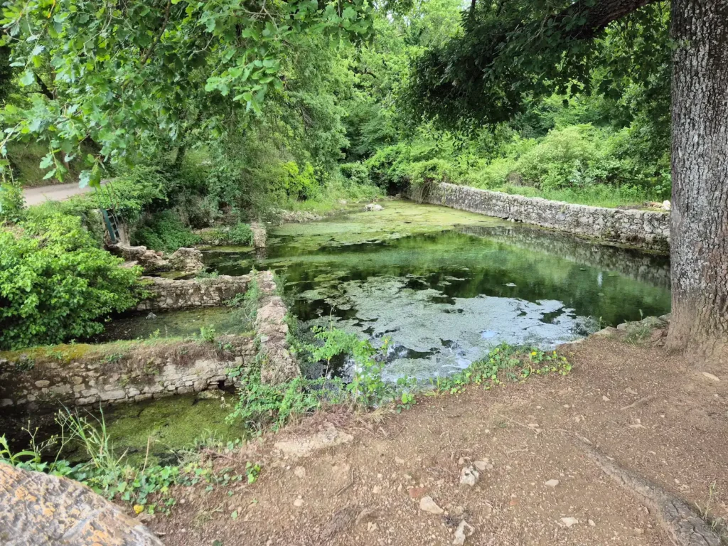
Leaving Gracciano dell’Elsa, we turned onto a narrow road leading to Le Caldane – thermal baths with roots in Etruscan and Roman times, and a medieval structure dating back to the 13th century. Although the ancient walls and floor are covered in green algae, the water is clear, if a little brisk. There was nobody in the pools when we arrived, but they would make a good mid‑hike swimming spot in warmer weather.
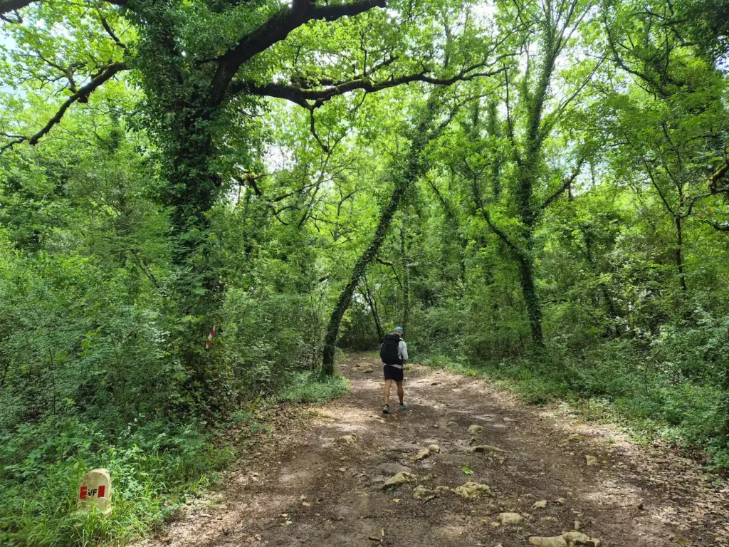
After Le Caldane, we walked on dirt paths and gravel tracks, weaving through forests and wheat fields, and passing olive groves and vineyards. At around 12:30 PM, after covering roughly 12 km, we reached the village of Strove and stopped for lunch at La Locanda, a small restaurant with outdoor seating. Just before the restaurant we passed a few park benches – a rare sight over the first two days – that would have made a good picnic spot. Our 45-minute break gave us time to air out our feet and fully dry our shoes and socks after the morning’s river crossing.
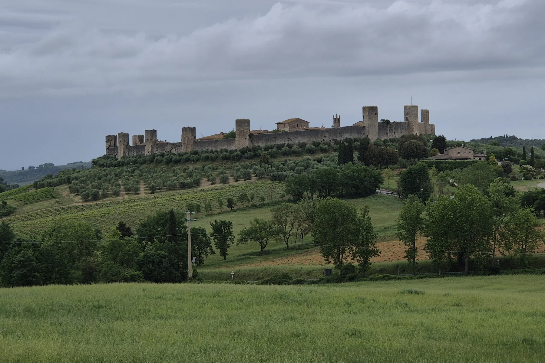
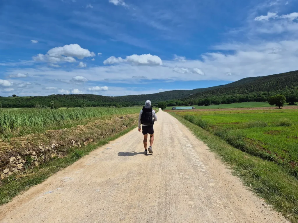
Approaching Abbadia a Isola, a medieval hamlet with a 1,000-year-old Benedictine abbey, we caught our first glimpse of Monteriggioni perched high on its hill. The final 4 km were a gradual approach as the city walls drew closer, followed by a short, steep climb to Porta Fiorentina, the town’s 13th-century northern gate.
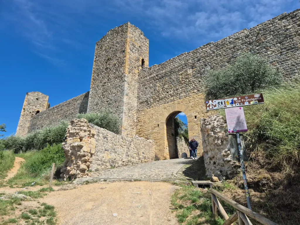
We reached a cold and windy Monteriggioni shortly after 3 PM. We had hoped to walk along the city walls, which offer panoramic views of the Elsa Valley, the Chianti hills, and the towers of San Gimignano on a clear day. Unfortunately, they were closed due to ongoing renovations.
Monteriggioni is small, and accommodation within the walls is limited. We were fortunate to have a reservation at Rooms and Wine, a boutique guesthouse with a tasting room dating back to the 1200s, according to their website. Anyone hoping to stay within the walls should book early.
About Monteriggioni
Monteriggioni is a circular hilltop fortress built by the Republic of Siena between 1214 and 1219 to guard the northern approach to the Elsa Valley. Its walls, punctuated by fourteen towers, follow the natural curve of the hill. The fortress was established as a front‑line outpost in the long conflict with Florence. It remained Siena’s northern stronghold for more than three centuries, resisting repeated attacks until Siena surrendered in 1555.
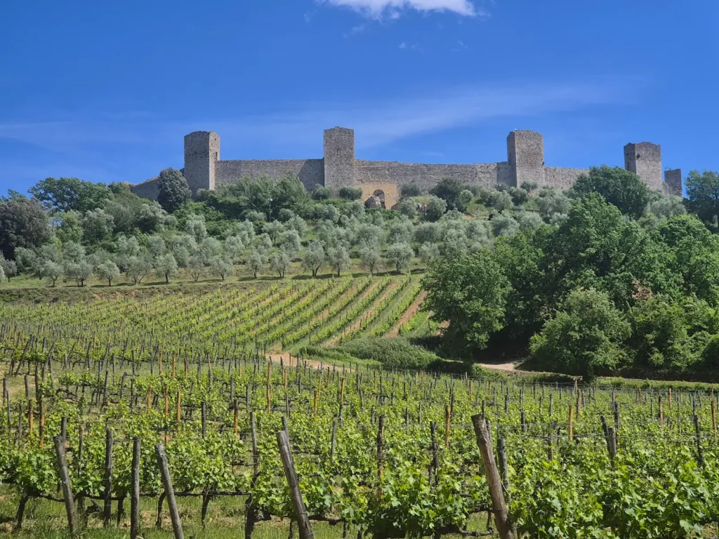
The settlement inside the walls remains small and largely unchanged: a single piazza, a Romanesque church, and a compact cluster of stone houses originally built for soldiers and their families. With the end of its military role, Monteriggioni became a quiet rural village surrounded by farmland, vineyards, and olive groves.
Today, it is known for the exceptional preservation of its medieval fortifications, with tourism and the surrounding farmland sustaining the village.