My challenge in a nutshell
| Type: | Long-distance, multi-day hike |
| Location: | Table Mountain National Park, Cape Town, South Africa |
| Start/Finish: | Signal Hill |
| Distance: | 106 km |
| Hiking time: | 36 hr (including stops) over 4 consecutive days |
| Elevation gain: | 7090 m |
| Elevation range: | 0–1086 m |
| Average day: | 26.7 km, 9 hr 0 min, 1770 m gain |
| Longest day: | 30.6 km, 10 hr 52 min, 2340 m gain (Day 2) |
| Shortest day: | 26.3 km, 6 hr 30 min, 1170 m gain (Day 3) |
| Difficulty: | Very strenuous |
Hiking the 13 Peaks
When I first heard about the 13 Peaks Challenge, I knew straight away that I wanted to do it. Four days of hiking across a UNESCO World Heritage Site, panoramic views of the Atlantic Ocean and Table Mountain National Park, an intense physical challenge, and the convenience of basing myself in the city – it had all the ingredients of a great adventure.
After months of planning and seven weeks of focused training, I completed the challenge in February 2026.
This article covers:
- What the 13 Peaks Challenge is
- What makes it special – and challenging
- Safety considerations
- My four-day challenge
- Where I based myself in Cape Town
- My hiking gear
If you’re planning to do the 13 Peaks and have questions I haven’t covered, feel free to get in touch.
What is the 13 Peaks Challenge
In 2019, South African ultra-trail runner Ryan Sandes linked together 13 of his favourite summits across the Cape Peninsula into one continuous loop. That route became the 13 Peaks Challenge.
Starting and finishing on Signal Hill in Cape Town, the route covers more than 100 km with roughly 6500–7000 m of elevation gain. Along the way, it passes well-known landmarks including Lion’s Head, Maclear’s Beacon, Chapman’s Peak, and Devil’s Peak.
The challenge is straightforward: tag all 13 peaks under your own power. How you get between them, and how long it takes, is entirely up to you. The official route is outlined on the 13 Peaks website.
The peaks (in order):
- Signal Hill – 350 m
- Lion’s Head – 669 m
- Maclear’s Beacon – 1086 m (highest point on Table Mountain)
- Grootkop – 857 m
- Judas Peak – 302 m
- Little Lion’s Head – 437 m
- Suther Peak – 623 m
- Chapman’s Peak – 592 m
- Noordhoek Peak – 742 m
- Muizenberg Peak – 507 m
- Constantiaberg – 927 m
- Klassenkop – 681 m
- Devil’s Peak – 1000 m
What makes the 13 Peaks special
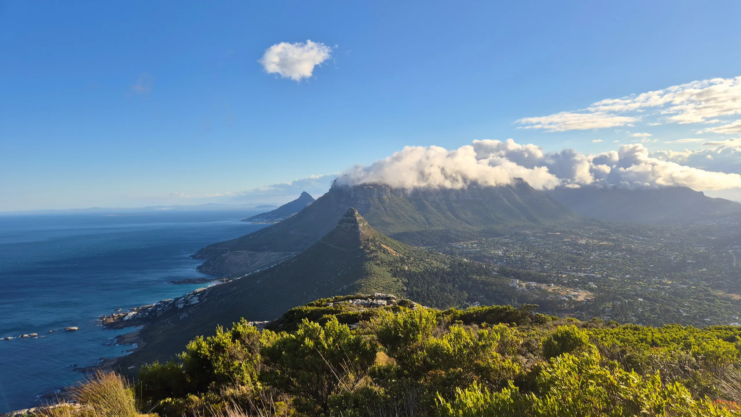
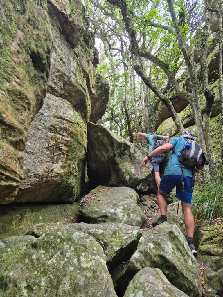
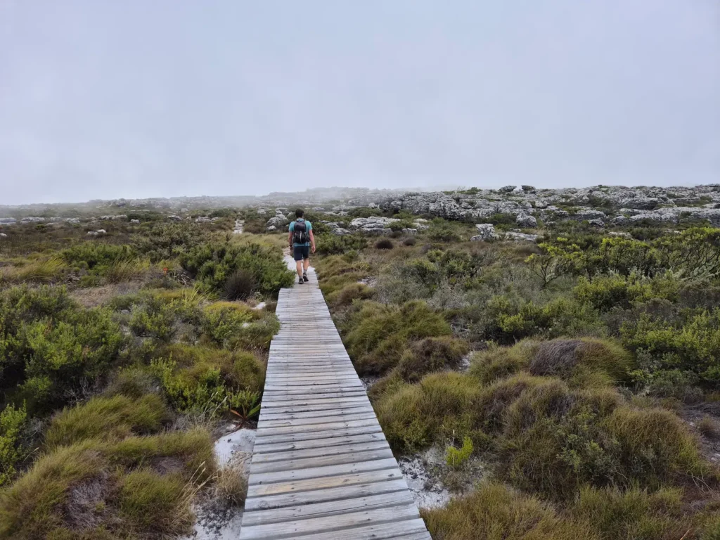
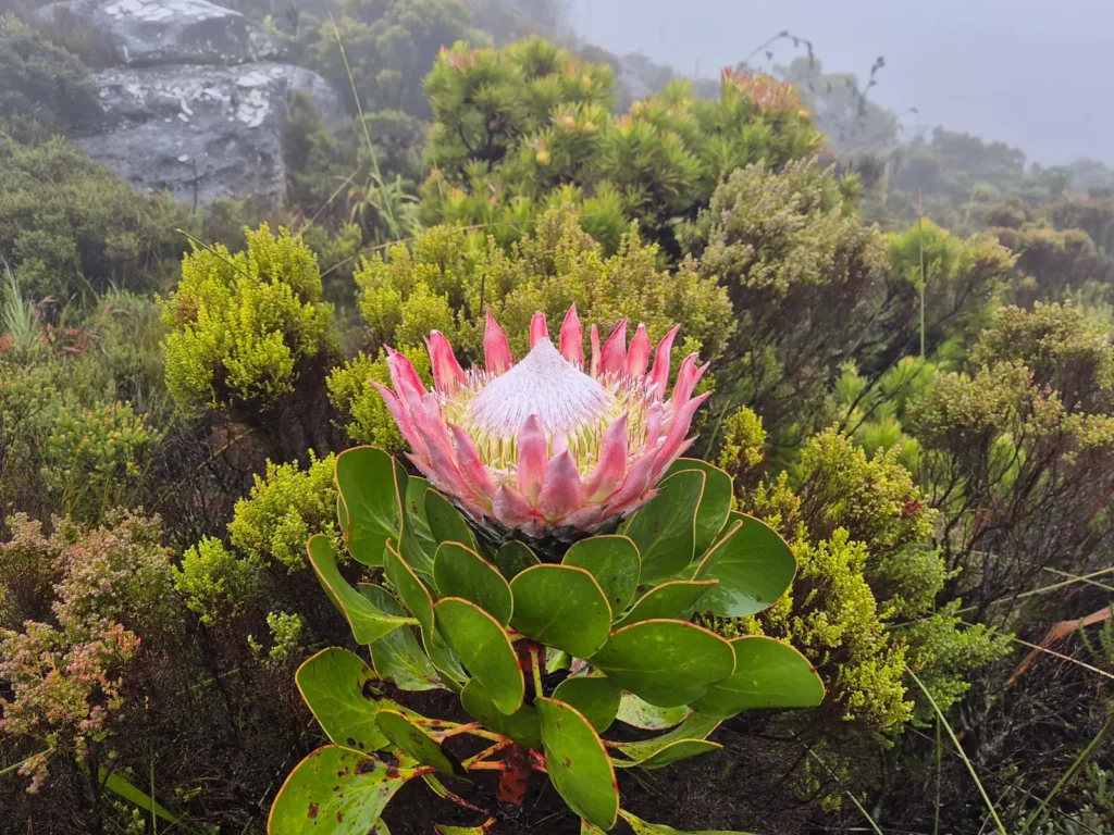
The route reveals the Cape Peninsula as a single, connected mountain range. You move through valleys, forests, and boulder fields, pass fynbos, cliffs, and reservoirs, and follow ridgelines with wide‑open ocean views. The beauty and diversity of the landscape are striking. At times you feel deep in the wild, even though the city is never far away. It’s an unusual combination of rugged terrain and urban proximity.
What sets the challenge apart, though, is its ethos. It isn’t a race but a personal undertaking. Some people complete it in under 48 hours, while others spread it across a few days, several weekends, or an entire season. There’s no prescribed pace – only the satisfaction of moving across the mountain, one summit at a time.
What makes the 13 Peaks challenging
The difficulty of the 13 Peaks depends largely on how many days you take to complete it. I have huge respect for runners who tackle it in two days. Ryan Sandes himself tagged all 13 peaks in 13 hours 41 minutes – practically superhuman.
I completed the challenge over four consecutive days, averaging 27 km and 1770 m of elevation gain per day.
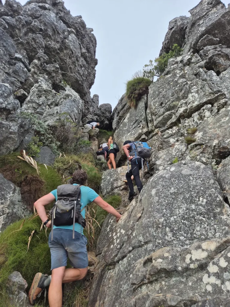
The distances aren’t the hard part – it’s the steep gradients, the constant ascents and descents, and the technical terrain. Day 2 alone involved more than 2300 m of climbing – the most I’d ever done in a single day. Add in blazing sun, high-speed gusts of wind, fog, rain, and long days on the trail, and it becomes clear why I rate the hike as very strenuous.
Safety considerations
I did the challenge with Nyati-X, a Cape Town‑based adventure company that I would highly recommend. There were three of us in the group: two hikers and one guide. Even if you’re an experienced hiker, completing the 13 Peaks with a team is a sensible choice.
Some sections of the national park are not recommended for solo hikers, and robberies do occasionally occur. The weather can shift quickly, and there are long stretches with no mobile coverage. Nyati‑X guides know the route well, carry satellite trackers, and take a safety‑first approach.
My 13 Peaks Challenge
Here’s a brief account of how each day unfolded.
Day 1: Signal Hill to Suikerbossie
Hike: 25.7 km, 9 hr 44 min, 1763 m gain
Peaks: Signal Hill, Lion’s Head, Maclear’s Beacon, Grootkop, Judas Peak
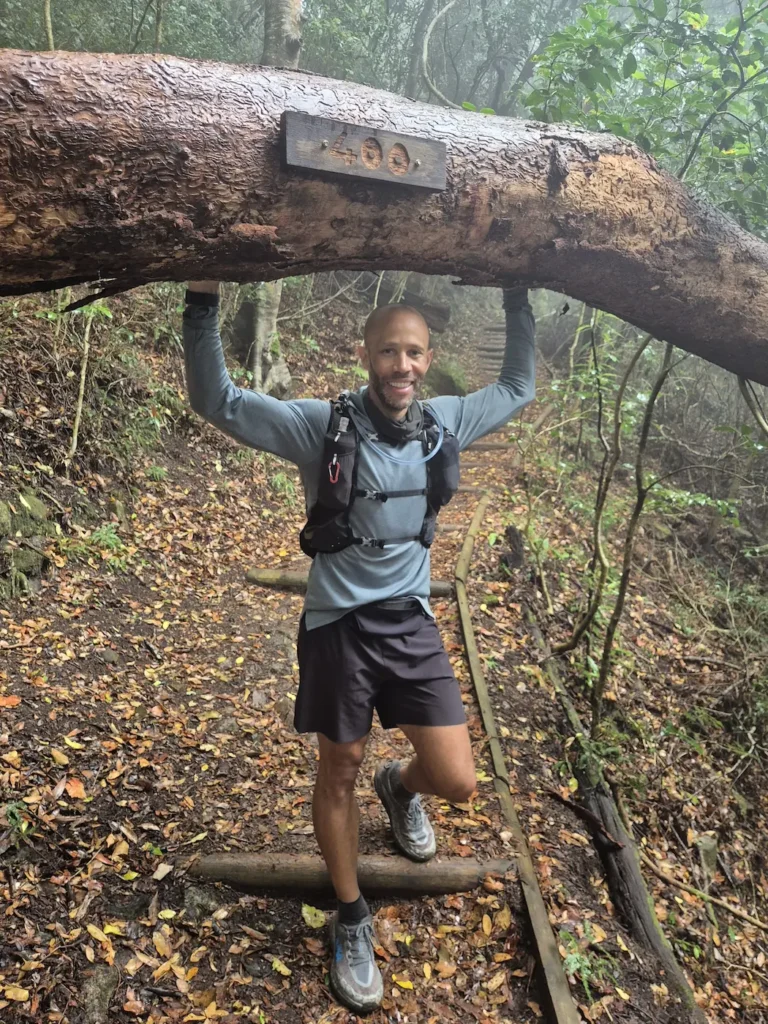
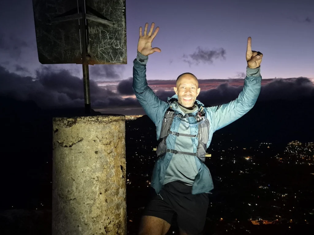
I woke up at 3 AM – earlier than necessary, but excitement and nerves had me wide awake. After breakfast and a pickup from Nyati-X, we reached the Signal Hill gate at 4:45 AM, only to find it locked. We could either start from the gate and take a shorter path to Lion’s Head or walk the extra 2.6 km to the official starting point. We chose the official route – no shortcuts on Day 1.
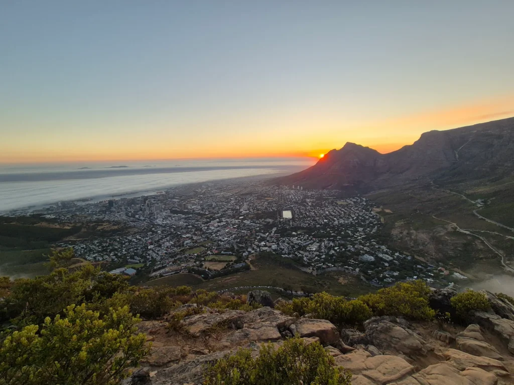
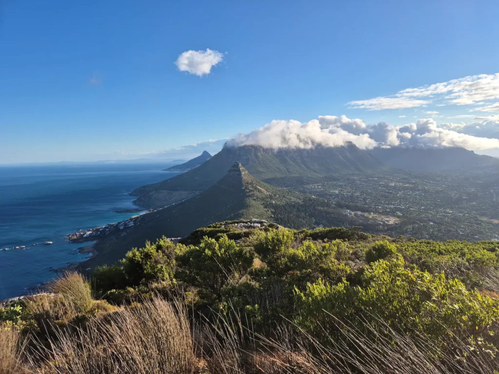
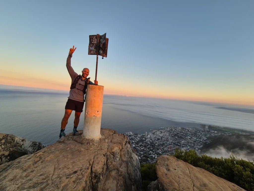
We reached Lion’s Head around 6:15 AM, just in time for sunrise. After descending, we faced our next decision: take the more popular Platteklip Gorge route up Table Mountain or the longer, more technical India Venster. We chose India Venster – a challenging route with scrambling, steep drop‑offs, and a whole lot of fun.
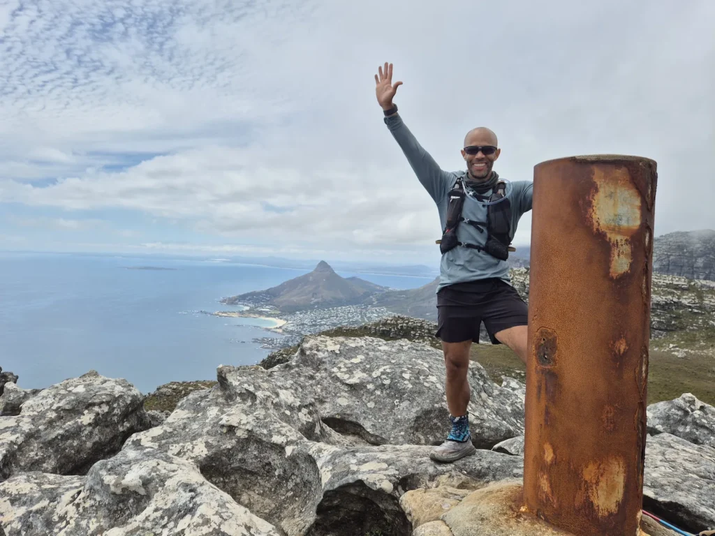
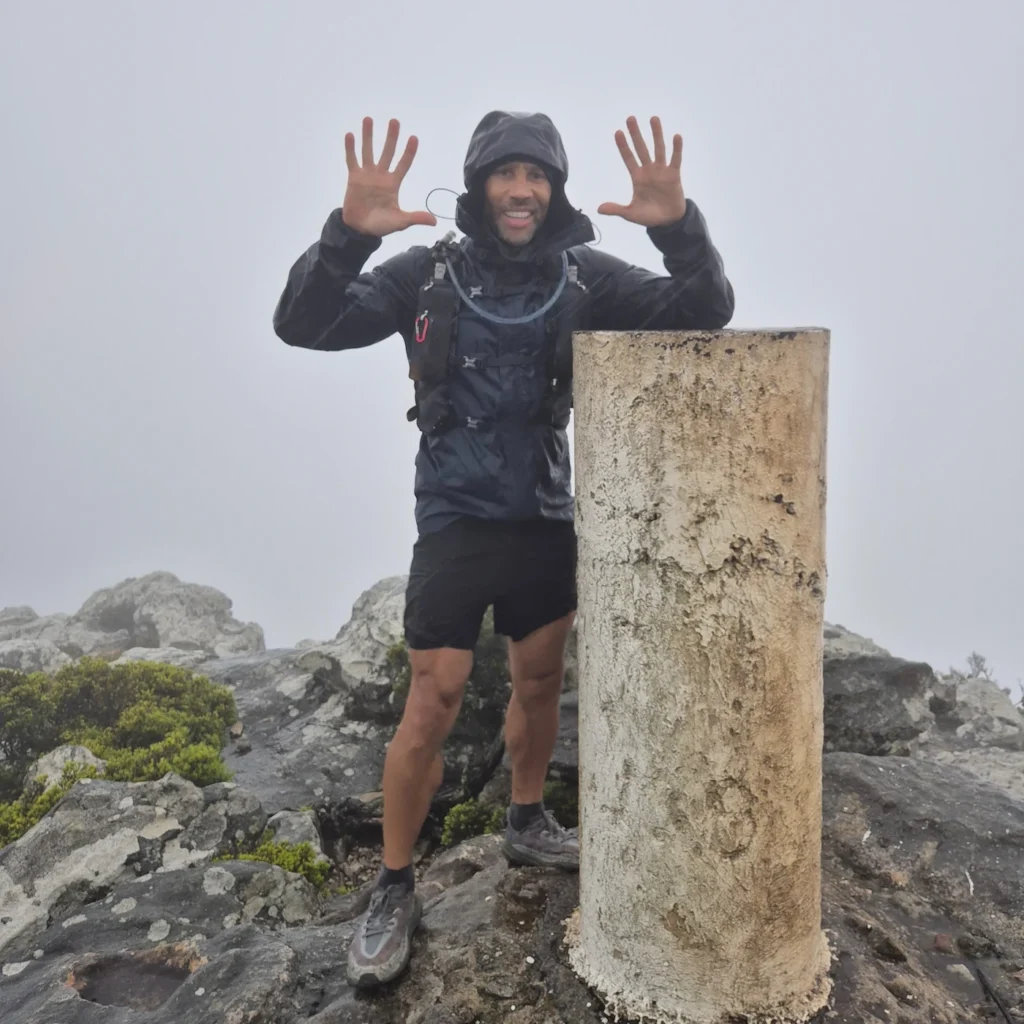
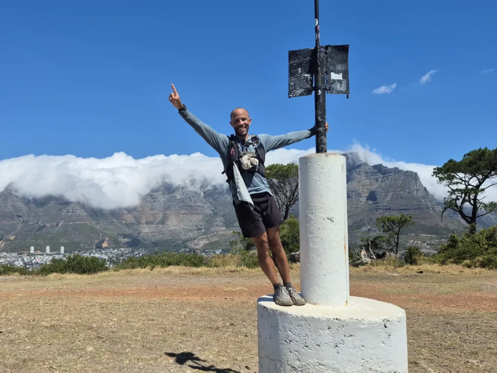
Maclear’s Beacon, the highest point on Table Mountain, was next. We reached it roughly 3 hours 30 minutes after summiting Lion’s Head. The first two climbs of the challenge were big ones – welcome to the 13 Peaks.
We finished the day at Suikerbossie after more than 10 hours on the trail, including the extra 2.6 km at the start. We briefly considered squeezing in the next peak, Little Lion’s Head, to ease Day 2, but our legs had other plans.
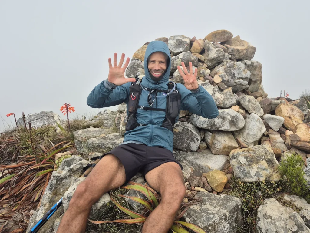
Day 2: Suikerbossie to Silvermine Nature Reserve (Gate 1)
Hike: 30.6 km, 10 hr 52 min, 2340 m gain
Peaks: Little Lion’s Head, Suther Peak, Chapman’s Peak, Noordhoek Peak
This was the toughest day: four peaks, over 2300 m of climbing, and more than 30 km of hiking. It was also one of the most rewarding.
We hit the trail at 5 AM, summiting Little Lion’s Head before sunrise. Suther Peak came next, offering some of the best panoramic views of the entire challenge.
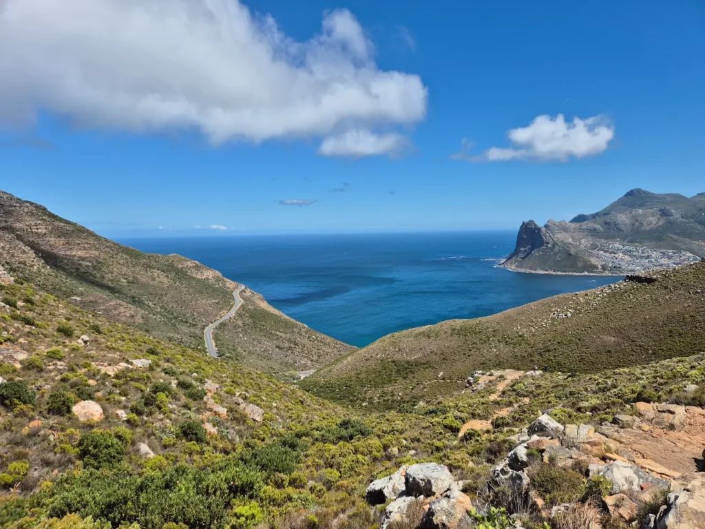
After descending the second peak, we passed through Hout Bay and walked several kilometres along Chapman’s Peak Drive. I hadn’t been looking forward to this section, as being off the mountain and on tarmac didn’t sound appealing. I was wrong. There’s a reason this stretch is considered one of the most scenic coastal roads in the world: the sweeping views of the ocean and cliffs are exceptional.
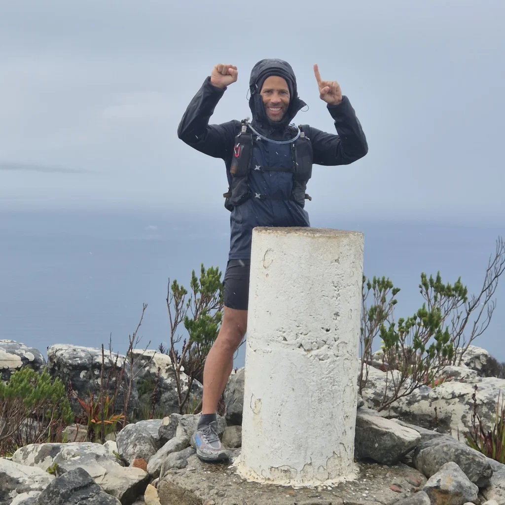
The fourth and final summit of the day was Noordhoek Peak, where I encountered the strongest gusts of wind I had ever experienced. I had to crouch behind the beacon rocks to take photos.
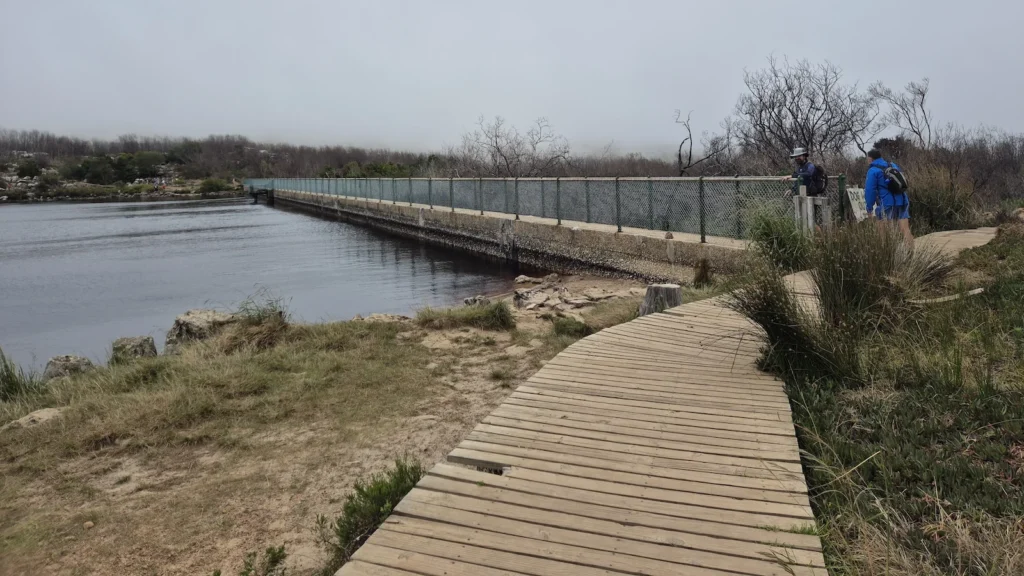
After the final descent, we passed Silvermine Dam and had time for a quick swim. The cold, tea-coloured water – stained by natural tannins from the fynbos – was the perfect reset before finishing the day after almost 11 hours on our feet.
A pre-dawn summit, incredible views, a scenic road walk, and a dip in a tea-coloured reservoir – this day had everything.
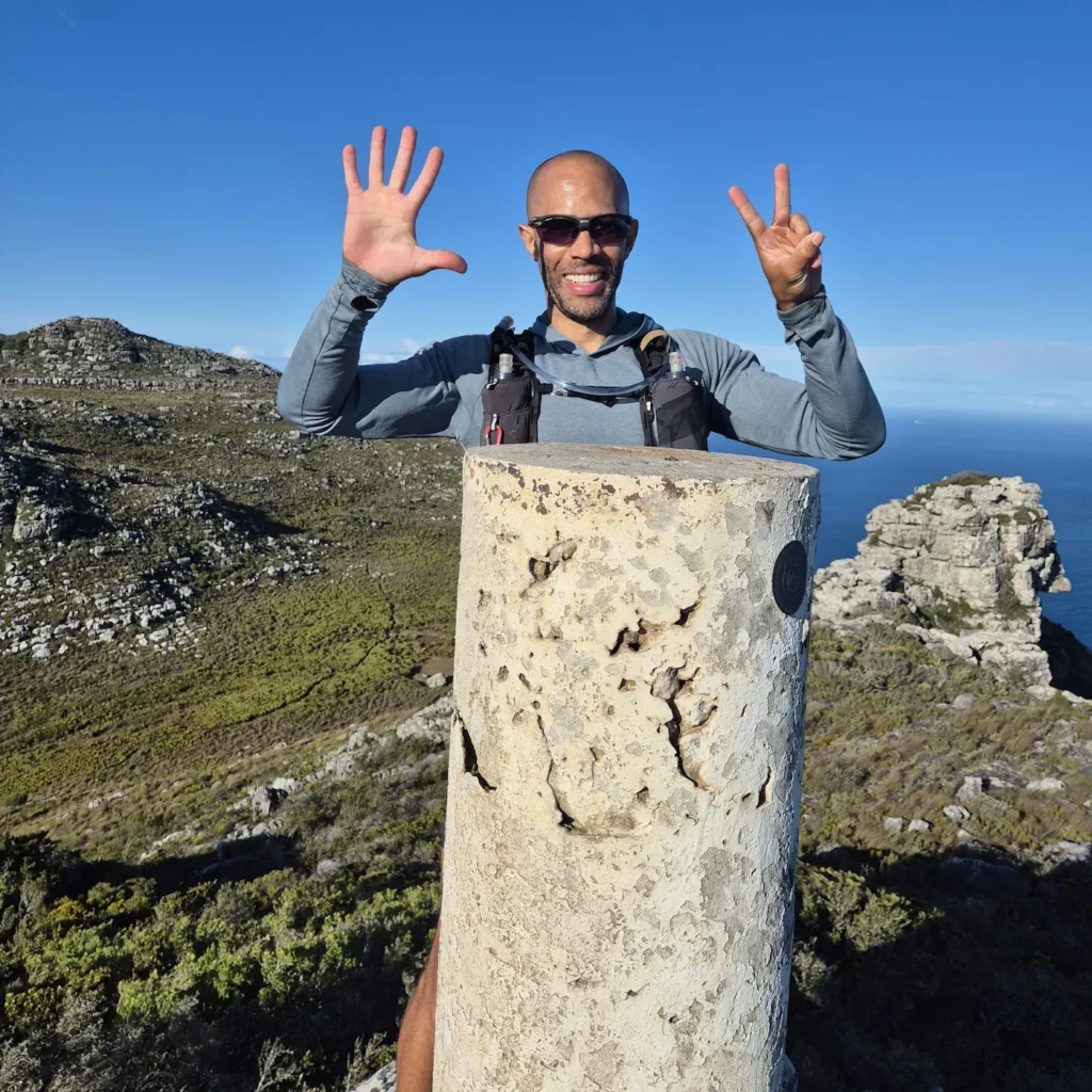
Day 3: Silvermine Nature Reserve to Constantia Nek
Hike: 26.3 km, 6 hr 30 min, 1171 m gain
Peaks: Muizenberg Peak, Constantiaberg
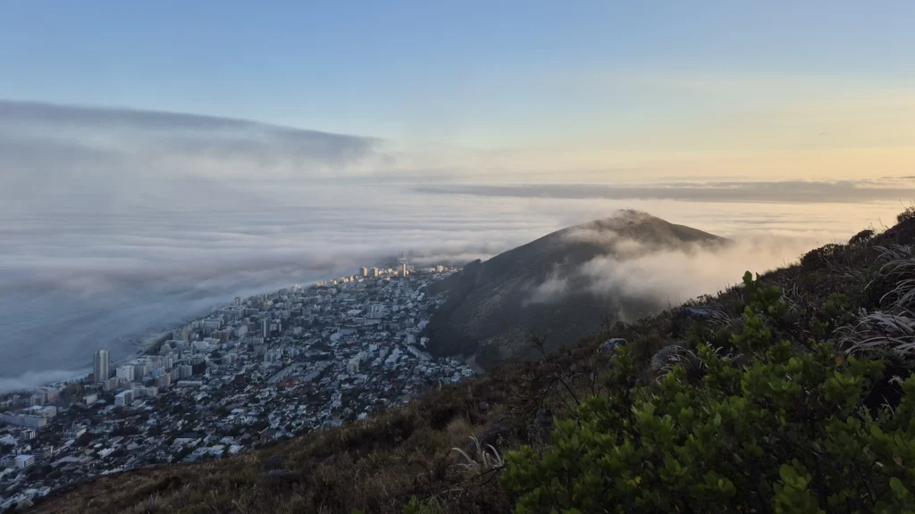
With less than 1200 m of elevation gain and only two summits, Day 3 looked relatively easy on paper compared to the previous two days. But I woke up feeling below par. Two long days of hiking, more than 4000 m of climbing, wind chills on Noordhoek Peak, and a cold swim in Silvermine Dam had all caught up with me. To make things worse, it rained throughout the day.
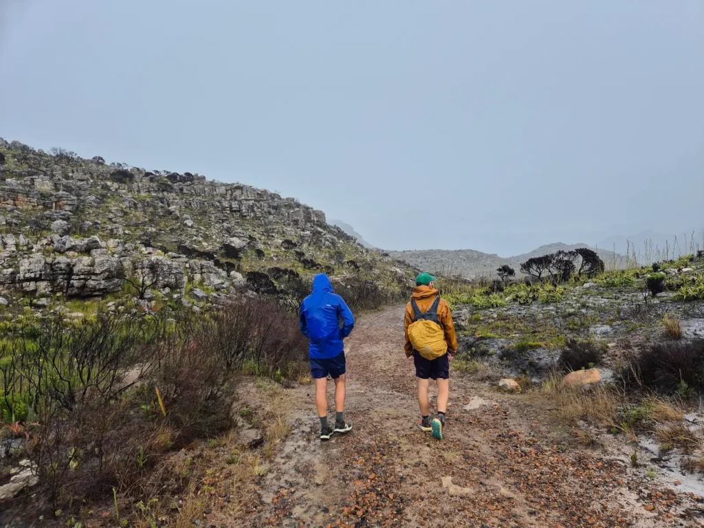
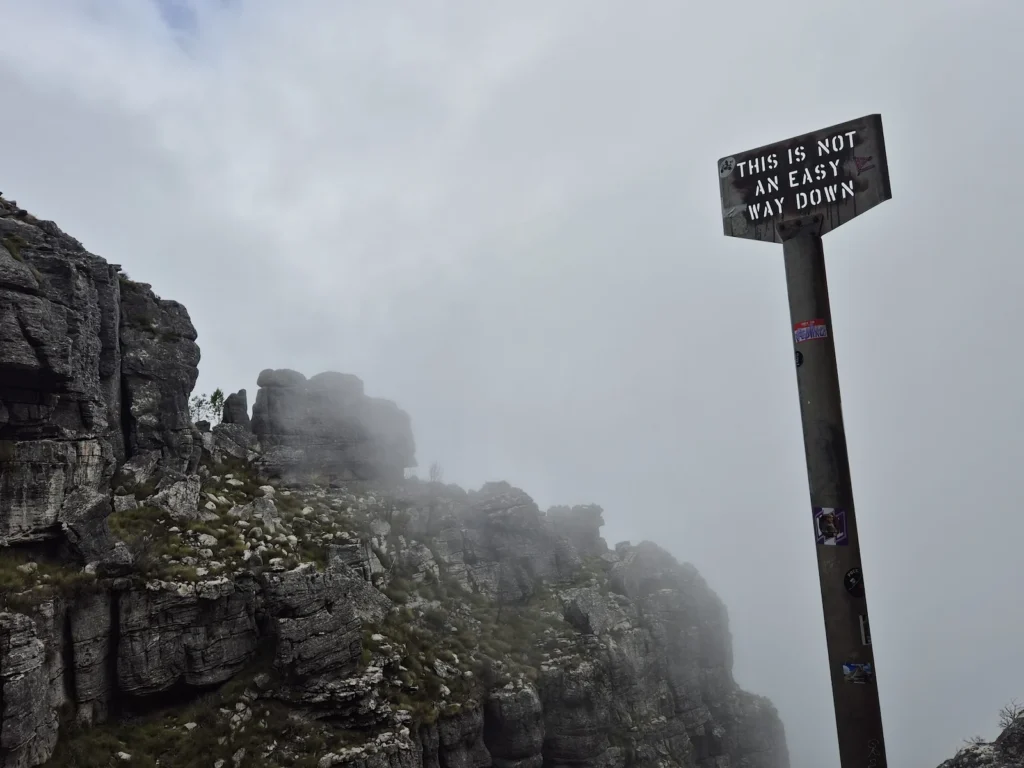
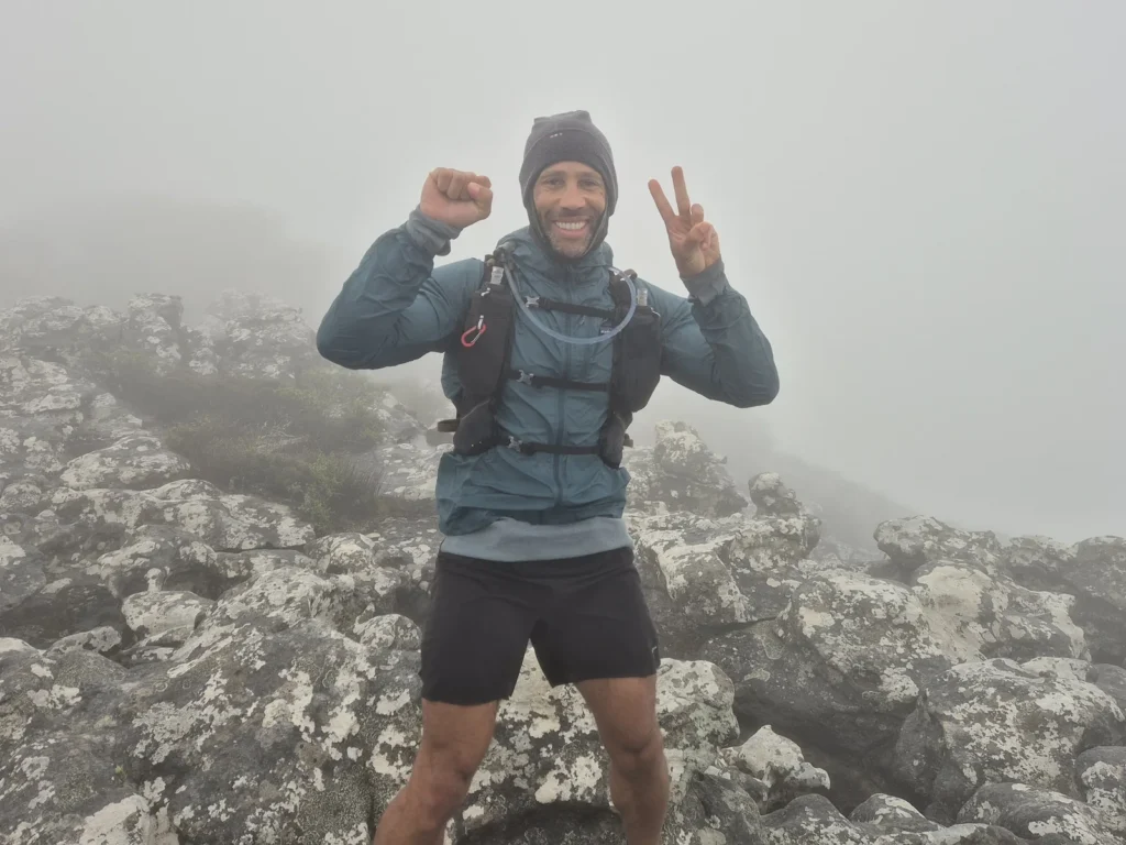
We reached Muizenberg Peak just as a storm rolled in. Had we been 15 minutes later, we would have had to skip the summit and break the sequence. Muizenberg is known for its incredible views over False Bay. We had rain, fog, and only a few metres of visibility.
I pushed through the 26 km and finished at Constantia Nek after 6 hours 30 minutes, grateful that my “off” day aligned with a shorter stage.
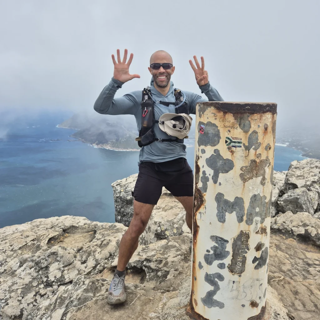
Day 4: Constantia Nek to Signal Hill
Hike: 24.1 km, 8 hr 55 min, 1819 m gain
Peaks: Klassenkop, Devil’s Peak, Signal Hill
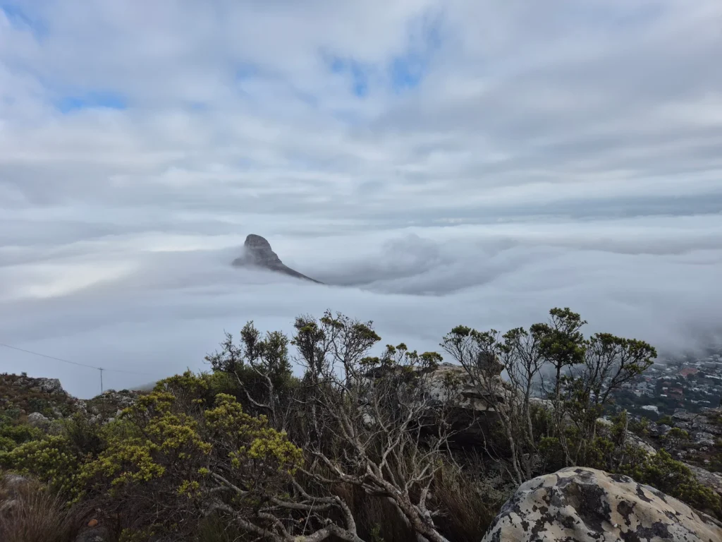
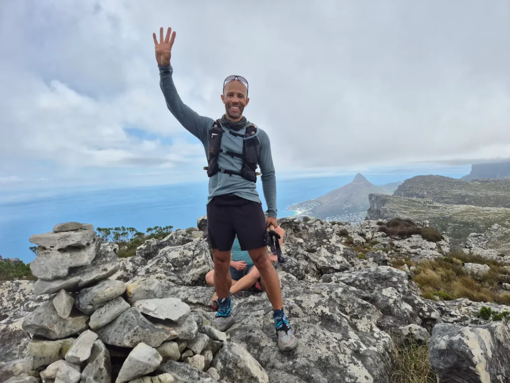
I was back to full strength, or close enough, on the fourth and final day. We set off at 5:30 AM and reached a fog‑covered Klassenkop a little over an hour later, with visibility under 20 metres.
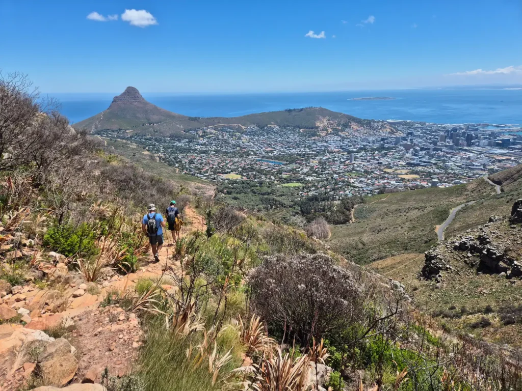
We descended Nursery Ravine and followed Contour Path, one of the most scenic forest trails on Table Mountain, for 4.5 km before zig-zagging back up the mountain towards our final summit.
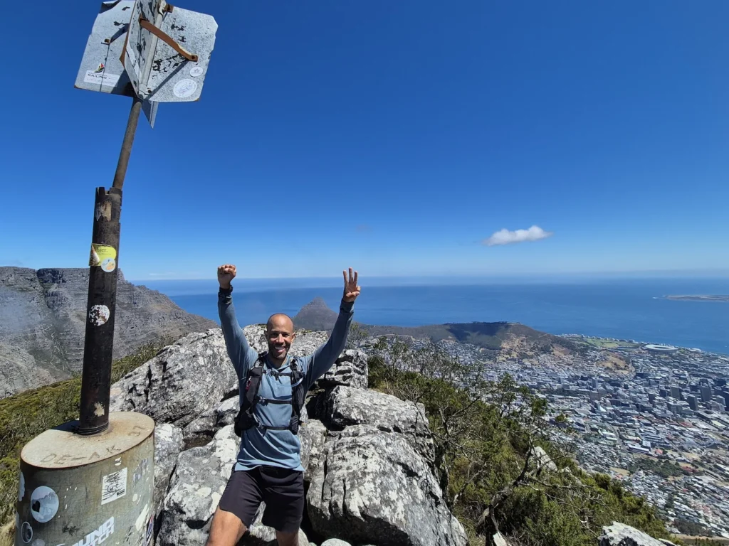
Devil’s Peak is often covered in cloud, with little visibility of its surroundings, but on this afternoon the skies opened. We were rewarded with panoramic views of Table Mountain’s plateau, Lion’s Head, Signal Hill, and the City Bowl. The hard work was done. From here, it was a 10 km home stretch to complete the 106 km loop.
After 36 hours on the trail, we were back at Signal Hill.
Where I based myself in Cape Town
One advantage of this multi-day hike is that you can base yourself in one place. Each morning, you take a taxi to the point where you left the trail the previous day. At the end of the day, you take a taxi back to your base.
For the four‑day challenge, the start and finish points are:
- Signal Hill
- Suikerbossie
- Silvermine Nature Reserve (Gate 1)
- Constantia Nek
Given the long days and early starts, it’s wise to choose a location with easy access to these points. I stayed in Tamboerskloof in the City Bowl. My shortest trip was to Signal Hill (10 minutes), and my longest was to Silvermine Nature Reserve (35 minutes).
My hiking gear
Table Mountain throws everything at you: heat, wind, rain, fog, and cold. Sun protection, a windbreaker, a rain jacket, and a fleece are essential. With long distances and big elevation gains each day, the goal is simple: pack light and be comfortable.
What I wore:
- Legionnaire sun hat
- Sunglasses
- Merino neck buff
- Mier long-sleeve sun hoodie
- Danish Endurance boxer underwear
- Kiprun trail running shorts
- Kiprun smartphone waistband
- Darn Tough merino socks
- Hoka Speedgoat 6 trail runners
- Ankle gaiters
What I carried:
- Smartwool merino beanie
- Quechua full-zip fleece
- Patagonia Houdini wind jacket
- Quechua lightweight waterproof jacket
- Evadict 15 L hydration vest
- 2 L water bladder
- 500 mL soft flask ×2
- Fizan Compact 3 trekking poles
I carried trekking poles for the first two days, but the rocky terrain and scrambling meant they spent most of the time strapped to my pack. If I did it again, I’d leave them at home.
Final thoughts on the 13 Peaks Challenge
The 13 Peaks is one of the most rewarding ways to experience the diversity of Cape Town’s mountains. It’s tough, sometimes unpredictable, and always spectacular – a route that reveals the entire peninsula from all sides.
If you enjoy long days on the trail, big climbs, and the feeling of moving across a mountain range under your own power, the 13 Peaks is an unforgettable adventure.