This daily hiking log is part of an eight-day series following my wife and me on a 140 km hike through Tuscany. You can find the full story and logs for the other days on the Tuscany page.
My day in a nutshell
| Start: | Siena |
| Finish: | Buonconvento |
| Distance: | 32.3 km |
| Hiking time: | 8 hr 13 min (including stops) |
| Elevation gain: | 548 m |
| Elevation loss: | 733 m |
| Elevation range: | 144–344 m |
| Difficulty: | Strenuous |
Planning the day: Siena to Buonconvento
This was the longest day on the trail in both distance and time, and our fourth day on the Via Francigena. The official Stage 93 ends in Ponte d’Arbia, a quiet village about 27 km from central Siena. We chose to continue a little farther to Buonconvento, a larger medieval walled town with more history, restaurants, and accommodation options. The extra stretch added roughly 5 km to the day’s route, bringing the total distance to 32 km.
Many pilgrim hikers choose to skip the first section by taking public transport out of Siena. It removes the least rewarding part of the day: long stretches on pavement, traffic-heavy roads, and walking through industrial areas.
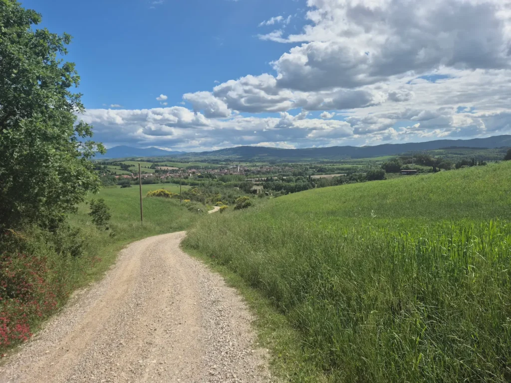
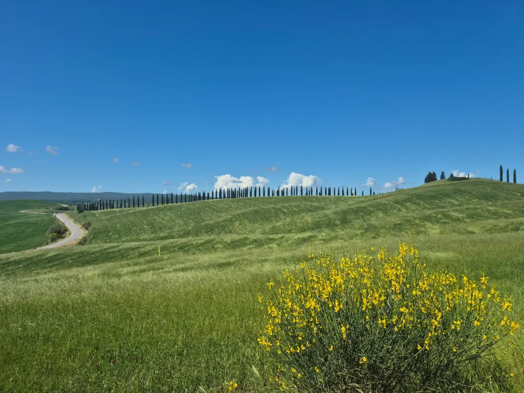
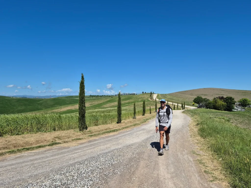
Starting farther south brings you into one of Tuscany’s most distinctive landscapes much sooner: the Crete Senesi. This region is known for its rolling clay hills, where pale slopes contrast with bright green farmland. It’s a classic Tuscan view of wide-open fields, isolated hilltop farmhouses, neat lines of cypress trees, and long white gravel roads.
Eve chose the transport option, taking a direct 20-minute train to Monteroni d’Arbia. With the 2.3 km walk to Siena station and 1.8 km from Monteroni d’Arbia station back to the Via Francigena, her total distance for the day became a more manageable 18.7 km.
Leaving Siena towards the Crete Senesi
I left our guesthouse at 7:20 AM, estimating that I would reach the meeting point with Eve – just under 18 km away – in about three and a half hours. Her train was leaving Siena three hours after me, arriving in Monteroni d’Arbia at 10:30 AM. From there, it would take her around 20 minutes to reach the meeting spot.
It was a chilly but sunny morning at about 6°C. One benefit of setting off early is that Piazza del Duomo and Piazza del Campo – Siena’s two main squares – are quiet and largely empty at that hour.
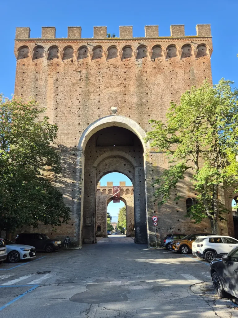
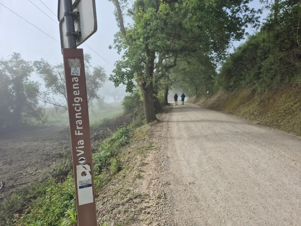
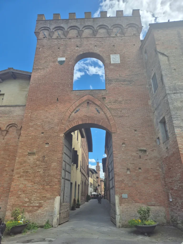
After pausing briefly for a few photos, I continued through Porta Romana, the city’s southern medieval gate. This 14th-century passage was built as a double-gated defensive system with two successive arches. Immediately beyond the gate, I turned left and began a gradual descent on a misty gravel track, starting the approach into the Val d’Arbia (the Arbia Valley).
At the 6.7 km mark beside a drinking fountain, the trail turned onto a riverside path before heading through the first of two industrial areas. This was a short section and I was soon back on a gravel path. Although it was an uninspiring stretch running between a main road on the right and train tracks on the left, I was glad to be off tarmac and a comfortable distance from traffic. Walking through the second industrial area, which I entered at the 9.3 km mark and just before the village of Isola d’Arbia, took a little longer.
The landscape changed dramatically once I reached the small hamlet of La Piaggia, about 10 minutes beyond Isola d’Arbia and just under 12 km into the day. Wide-open fields, rolling hills, and cypress trees marked the start of the scenery leading into the Crete Senesi – the landscape I had been looking forward to. I continued for another 6 km, taking in the views and enjoying the much warmer temperature, which had risen to 22°C, until I reached the outskirts of Monteroni d’Arbia, where I met Eve.
Monteroni d’Arbia to Buonconvento
My timing was spot on – we reached our meeting point within six minutes of each other. But keeping that pace meant walking briskly all morning, and I hadn’t factored in any breaks. With just over 14 km left, a short rest would have been sensible.
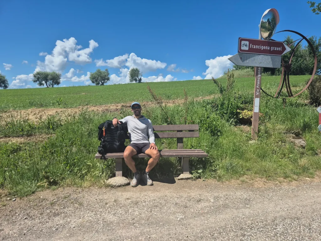
Reunited, we continued for another 2 km until we found a bench immediately after the small hamlet of Greppo. Even though it was beside the road with no shelter from the sun, I needed a rest after almost 20 km on my feet. Benches had been rare on this trip, so this would have to do. We stopped for 20 minutes while I ate my assortment of packed snacks: prosciutto, cheese, bread, and an apple.
Five hundred metres further down the track, as we entered the village of Quinciano, we found potable water and a shaded picnic table that would have been a better place to rest.
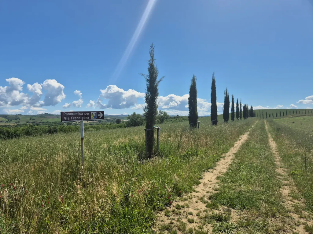
We continued through the village and crossed the SP34 provincial road, where the Via Francigena split in two. There was a lower route running alongside train tracks, and a slightly longer panoramic variant with a short, easy climb to a ridgeline. We took the panoramic route, which descended and rejoined the main path after 3 km.
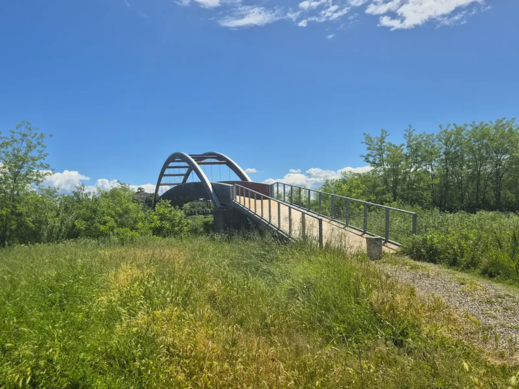
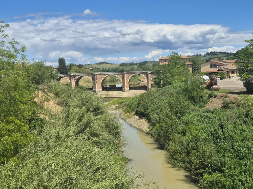
We reached Ponte d’Arbia, roughly the 27 km mark, at about 1:20 PM – a perfect time for a lunch break. We crossed the Arbia River over a modern steel and wood pedestrian bridge built in 2016. When the first restaurant we tried was full, we circled back over the 14th-century medieval bridge and found a café, where we enjoyed a sandwich, cappuccino, and a 45-minute rest.
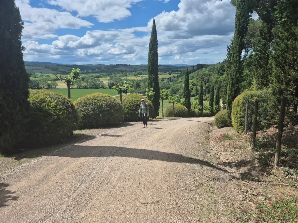
After lunch, we picked up our packs, crossed the medieval bridge once more, and continued the final 5 km to Buonconvento. The trail had more gravel tracks, classic cypress trees, and multi-coloured wheat fields in shades of brown, yellow, and vibrant green. I was enjoying the second half of the day; it was hot and exposed, but a welcome change after the heavy rain on Day 3.
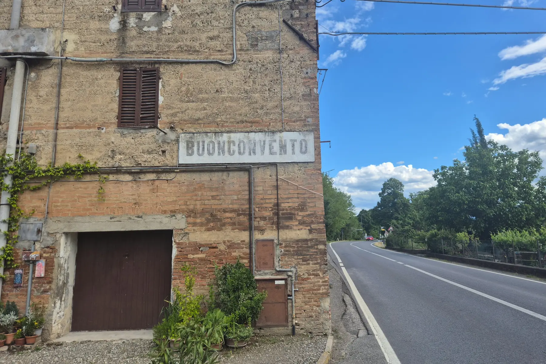
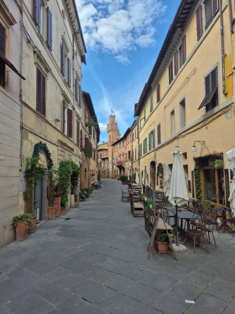
We reached Buonconvento through Porta Senese, a 14th-century gate on the northern side of town, and strolled down Via Soccini, the main street and historic heart of the town. We arrived at our guesthouse on the southern end shortly after 3:30 PM. It had been a long day, but we were glad we continued beyond Ponte d’Arbia – the calm atmosphere and well-preserved centre of Buonconvento made the extra distance worthwhile.
Buonconvento
Buonconvento is a small medieval town where the Val d’Arbia meets the first rolling hills of the Crete Senesi. Its name comes from bonus conventus – “a good gathering place” – reflecting the fertile land, the safe river crossing, and its position along the Via Francigena, which encouraged settlement from the 12th century.
Henry VII, the Holy Roman Emperor attempting to restore imperial authority in Italy, died here in 1313, briefly placing Buonconvento at the centre of European politics.
After a series of attacks, the town was fortified with brick walls between 1371 and 1385. As a Sienese outpost, it guarded the southern frontier and controlled movement along the valley.
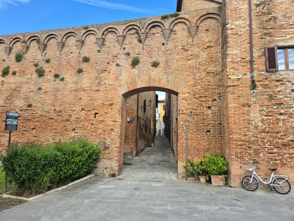
Inside its preserved brick walls, Buonconvento retains a compact historic centre with narrow streets and small palazzi: modest brick townhouses with arched doorways and family coats of arms.
Today, it is regarded as one of Tuscany’s best-preserved medieval settlements and a gateway to the Crete Senesi. Sitting on the valley floor, it offers a less crowded, more authentic atmosphere than many of the region’s popular hilltop towns.