This daily hiking log is part of an eight-day series following my wife and me on a 140 km hike through Tuscany. You can find the full story and logs for the other days on the Tuscany page.
My day in a nutshell
| Start: | Pienza |
| Finish: | Montepulciano |
| Distance: | 15.1 km |
| Hiking time: | 5 hr 32 min (including stops) |
| Elevation gain: | 594 m |
| Elevation loss: | 477 m |
| Elevation range: | 316–601 m |
| Difficulty: | Moderate to Difficult |
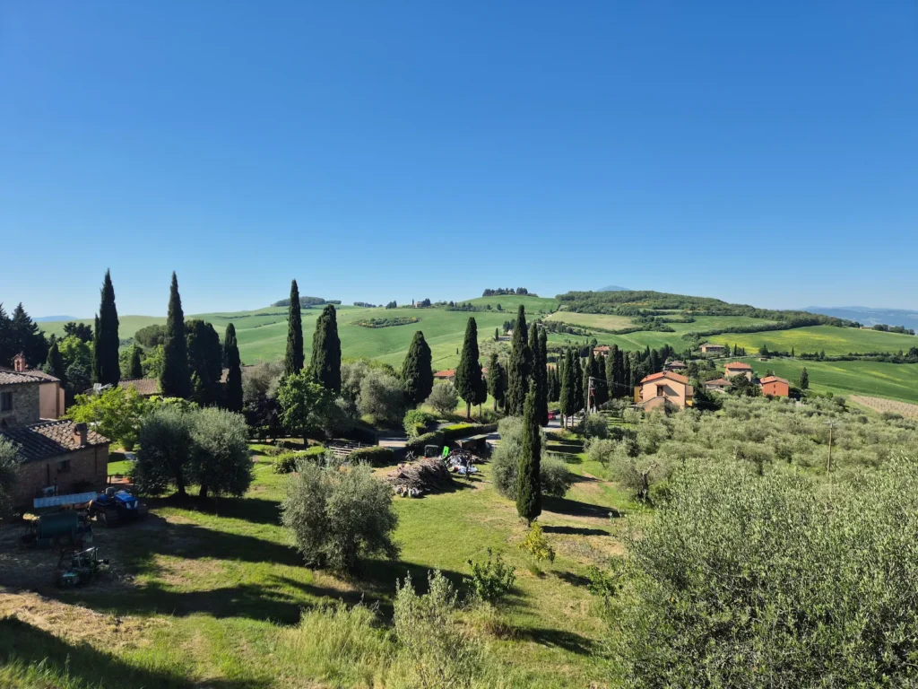
Leaving Pienza
The plan for our final day on the trail was to follow Chemin d’Assise, another long-distance pilgrim route, all the way to Montepulciano (see info box at end of article). Breaking from the previous two days’ routine, we chose not to visit a supermarket in the morning, as we would be passing through Monticchiello, a decent‑sized village, around the midway point.
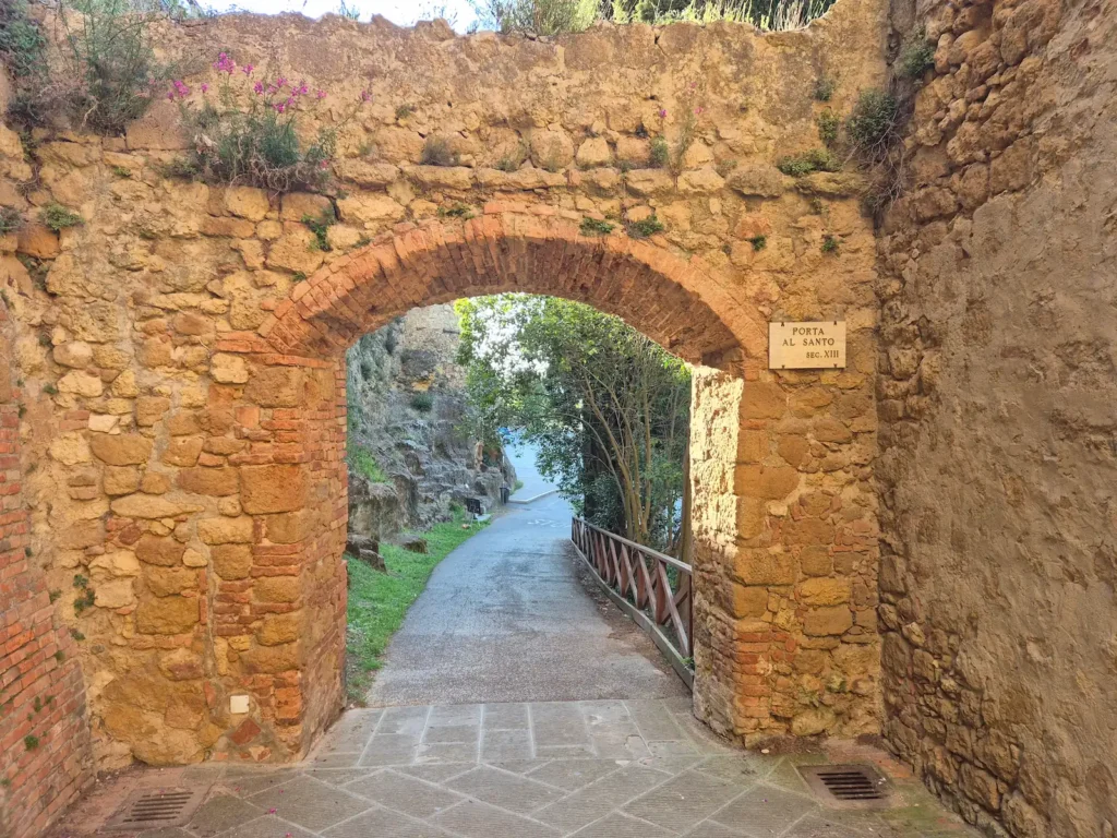
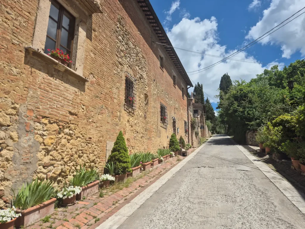
We set off early. The forecast suggested a warm day, and we expected to be exposed for much of the route. We left Porta al Prato, Pienza’s main western entrance, shortly before 7:30 AM. From there, we walked around the historic centre and exited through Porta al Santo, the southern gate.
It was another bright and sunny morning, and we had sweeping views of the Val d’Orcia as we descended the town’s hill. This was the first descent of the day, setting the tone for a series of ups and downs along the undulating route.
Pienza to Monticchiello
After leaving Pienza and crossing the SP18 provincial road beside the medieval wall, we continued our descent along a gravel track that rejoined the main road after roughly 500 m. We walked on tarmac for about 1.5 km before turning left and heading east on another gravel track, walking towards the morning sun.

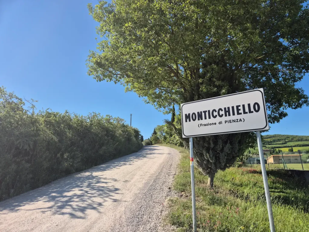
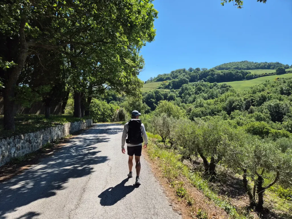
At the 5.5 km mark, the trail began its climb to Monticchiello, rising around 170 m over the next 1.8 km. The view behind us towards Pienza, with the morning sun illuminating the hilltop town, was as striking as the previous day’s.
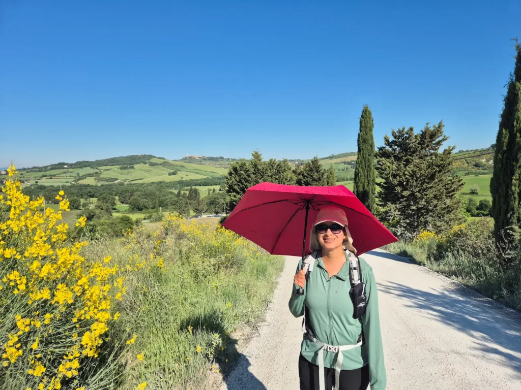
It wasn’t yet 9 AM, but the sun was already beating down on us. Eve raised her umbrella for some relief. It was clear that the day would be warm, and we were glad to have started early.
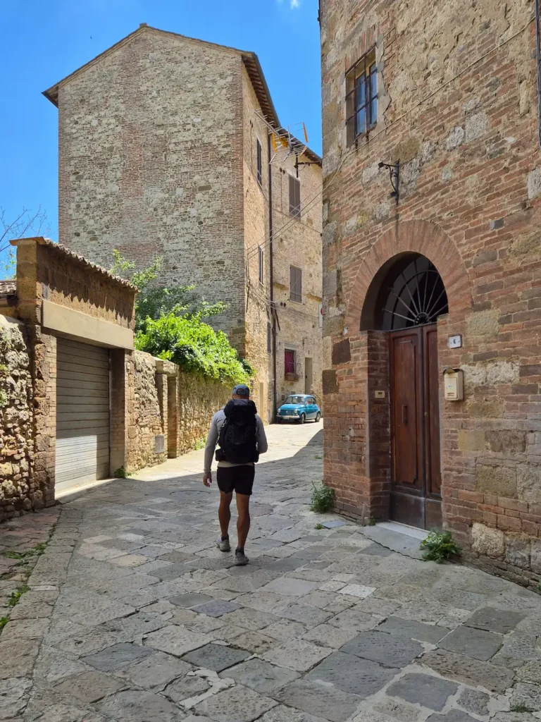
We reached Monticchiello (see info box below) at 9:30 AM, just as Angolo di Mezzo, a small café in the centre, was opening. We spent close to an hour sitting outside with a cappuccino and a panino, enjoying the quieter village atmosphere, which had far less tourist buzz than Pienza.
Monticchiello
First recorded in the 10th century, Monticchiello is a small fortified village overlooking the Val d’Orcia. Its ridge‑top position made it a natural defensive outpost on Siena’s southern frontier, and the surviving walls and gate still reflect this role. Through the Middle Ages, it functioned mainly as a rural stronghold rather than a commercial centre, relying on small‑scale agriculture, pastoral work, and local crafts.
Today, Monticchiello is known for its preserved medieval architecture and for the Teatro Povero, a community‑run theatre tradition created in the 1960s in response to rural depopulation.
Monticchiello to Montepulciano
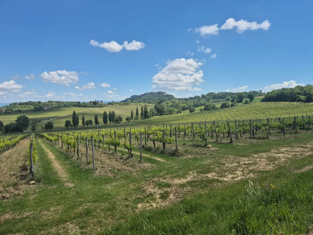
After our break, we left Monticchiello, descending for just over 1 km until we crossed the Fosso Lanese stream. The trail then climbed for 1.3 km to the top of the ridge, where we reached the Terre di Nano country estate. A well‑positioned bench overlooked the valley, the village we had left behind, and the town we were heading to: Montepulciano. Sensing that we might not come across another bench – and certainly not one with as good a view – we sat and rested our feet for a few minutes.
We set off on our third descent of the day. Ten minutes later, Eve realised she had forgotten her umbrella on the bench near the country estate. I dropped my pack, retraced my steps for around half a kilometre up the hill, and found the umbrella waiting exactly where we left it. I descended once again to rejoin Eve and collect my pack. Fortunately, it was a relatively short day, so my feet could handle an extra unplanned kilometre.
Reunited, we continued along the gravel road, crossing the Torrente Tresa stream. Shortly afterwards, we passed Parco di Villa Trecci, a three-hectare contemporary garden.
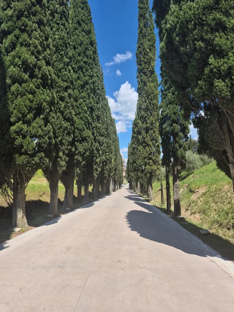
At the 13.5 km mark, the trail joined the SS146 state highway for around 200 m before turning left down Viale della Rimembranza, a cypress-lined memorial avenue created in the 1920s to honour Montepulciano’s fallen soldiers of World War I. Each tree had a stone marker at its base dedicated to a soldier.
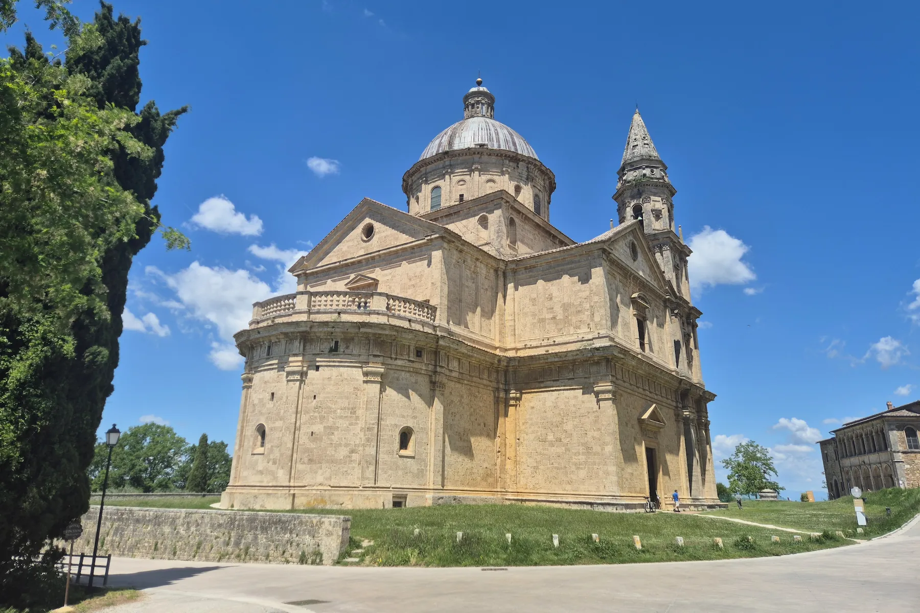
The avenue stretched around 350 m, leading to Tempio di San Biagio, a 16th‑century Renaissance church built in the shape of a Greek cross beneath a large dome that is considered one of the clearest examples of centrally‑planned architecture in Tuscany.
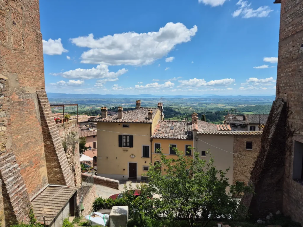
We turned right after the cathedral and began our third and final ascent of the day along Via di San Biagio towards Montepulciano’s historic centre. We entered the town through Porta dei Grassi, a 13th-century city gate, and continued on a steep climb before reaching Piazza Grande, the main square and highest point of the historic centre, just before 1 PM.
After eight days and 142 km, we had reached the end of our journey. The next day, we would take a bus to Chiusi‑Chianciano Terme train station, followed by a train back to Florence to catch our flight out of Italy.
Montepulciano
Montepulciano is a medieval and Renaissance hill town perched on a high ridge between the Val d’Orcia and the Val di Chiana, a position that has attracted settlers since Etruscan times.
The town grew in importance during the Middle Ages as a fortified centre caught between the ambitions of Siena and Florence. After frequently switching allegiances, it finally aligned with Florence in 1390, entering a period of Renaissance prosperity that has shaped much of its architecture.
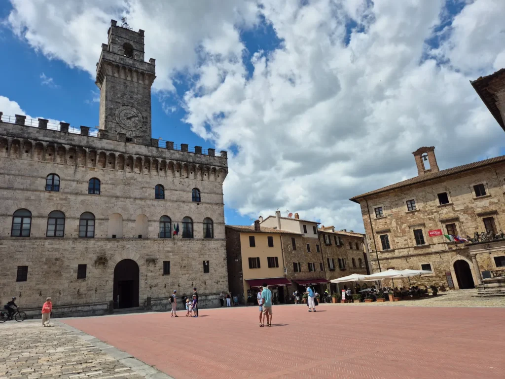
Today, Montepulciano is best known for its wine, Vino Nobile di Montepulciano, produced in the surrounding vineyards, and for its well‑preserved streets, panoramic views, and historic landmarks such as the Tempio di San Biagio.
Chemin d’Assise
Created in France in the late 20th century, Chemin d’Assise is a long‑distance pilgrimage route established to honour the life and teachings of St Francis of Assisi. Born into a wealthy merchant family in the late 12th century, Francis renounced his inheritance to live a life of poverty, simplicity, and service. He founded the Franciscan Order in 1210 and became known for his connection to nature, humility, and message of peace. He is now the patron saint of animals and the environment.
The route begins at several traditional French pilgrim centres, most commonly Vézelay, Cluny, or Le Puy‑en‑Velay. Heading south-east, it crosses through the Alps into northern Italy, ultimately ending at the Basilica of St Francis in Assisi, where the saint is buried. The total route covers around 1,500 km.
The French name translates literally as “Way to Assisi”, not to be confused with the Via di Francesco, the Italian Way to Assisi network that runs from Florence in the north or Rome in the south to Assisi.
Although less well‑known than the Camino paths and the Via Francigena, Chemin d’Assise attracts a steady number of pilgrims seeking a quieter, more contemplative journey to Assisi.