Why I rate hike difficulty
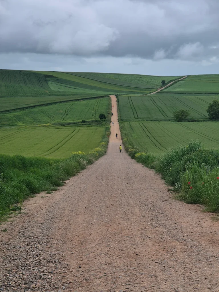
Hikes range in difficulty from short, easy walks to long-distance, high-altitude summits. Not all trails are suitable for everyone. Having a clear sense of difficulty helps you decide whether a hike suits your fitness and experience.
Each hike on this site includes a difficulty rating that reflects how tough it feels and how much effort it requires. I use a simple five‑level system: Easy, Moderate, Difficult, Strenuous, and Very Strenuous. It’s not meant to be scientific; it’s a practical guide based on trail characteristics and how a hike actually feels.
This article covers:
What influences a hike’s difficulty
A hike’s difficulty is shaped by several factors. Some matter more than others, but together they give a sense of how tough it will feel.
Elevation gain (metres)
Elevation gain is one of the strongest predictors of difficulty. The more you climb, the harder it feels. Sustained uphill effort raises your heart rate, increases fatigue, and adds time on your feet.
A 10 km trail with a 1000 m ascent is far more demanding than a 20 km trail that stays mostly flat.
Elevation gain is the first number I look at.
Duration (hours)
Duration reflects overall effort – time on your feet, energy spent, and how long you’re exposed to weather, terrain, and altitude. It’s the only subjective metric in this system.
Two hikers can take very different times on the same trail depending on fitness, pace, rest stops, or comfort on technical terrain, so use duration as a general guide.
Distance (kilometres)
Distance matters, but it’s a secondary factor because it’s partly captured by duration. A long, flat trail may feel easier than a short, steep climb, which is why distance alone doesn’t tell the full story.
It’s most useful when considered alongside elevation gain and duration.
Average gradient (%)
Gradient combines elevation gain and distance into a single number. Steeper gradients usually mean tougher hiking. It’s a useful sense‑check, but it can be misleading.
If a route includes long flat sections, the average gradient may appear low even though there are steep climbs. Similarly, a one-way trail will show twice the gradient of the same trail when hiked as an out-and-back. Both routes have the same elevation gain, but the one-way route has half the distance, so use gradient as a supporting metric, not a primary one.
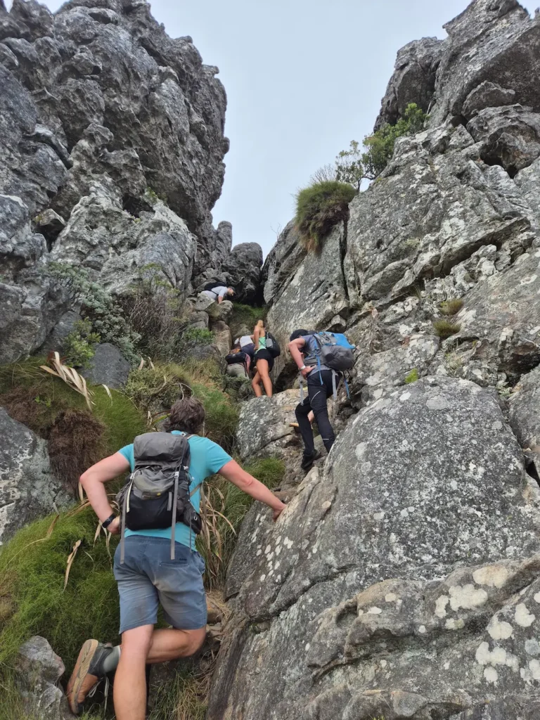
Terrain
Terrain can significantly affect how a hike feels. Smooth paths are easier, whereas rocky, loose, muddy, or exposed terrain increases effort. Scrambling, boulder fields, or narrow ridgelines slow progress and require more attention.
This is why technical terrain often makes a hike feel harder than the numbers suggest.
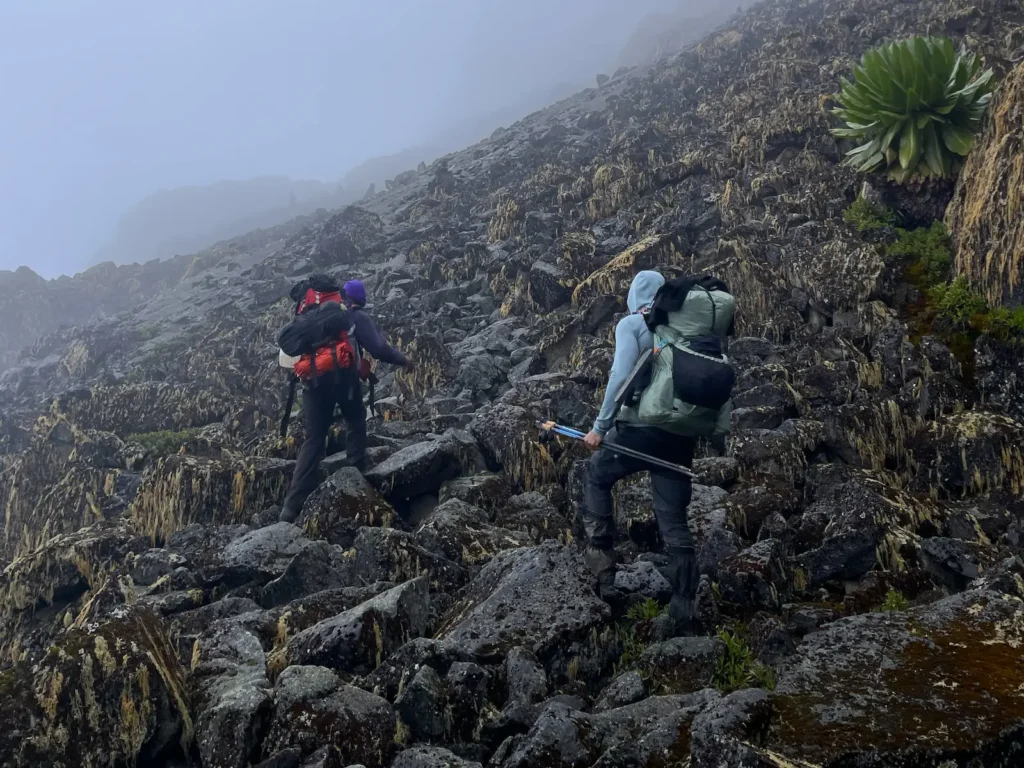
Altitude (metres)
Altitude has a major impact on effort. As elevation increases, the amount of oxygen available decreases, which affects breathing, pace, fatigue, and recovery.
Compared to sea level, the reduction in available oxygen at these altitudes is approximately:
- 3000 m: ~30% less
- 4000 m: ~40% less
- 5000 m: ~50% less
A hike that feels Moderate at sea level may feel Difficult or even Strenuous at altitude.
Other factors that influence difficulty
Some factors aren’t captured in the core stats but still influence how hard a hike feels. These are the main ones I consider.
Multi-day fatigue
Effort compounds over consecutive days. A 20 km day on fresh legs feels very different from the same distance on the fifth day of a thru-hike. Reduced recovery time, accumulated fatigue, sleep quality, and the mental load of knowing you must keep going all influence perceived effort.
Multi‑day context can move a hike up one difficulty level.
Backpack weight
Carrying extra weight increases energy expenditure and slows your pace. A light daypack adds minimal strain, but a 10–15 kg load makes ascending and descending harder, slows you down, and increases time on your feet.
Heavier packs amplify every difficulty factor.
Weather and exposure
Wind, heat, cold, rain, and sun exposure all affect perceived effort. High temperatures increase dehydration; cold conditions demand more energy; strong winds make ridgelines more taxing; rain or mud can turn an easy trail into a demanding one.
Hikes aren’t rated on unpredictable weather, but typical seasonal conditions are considered.
Navigation complexity
Not all trails are straightforward. Faint paths, confusing junctions, poor signage, or sections that drift in and out of visibility require more focus and decision‑making. Even with GPS, you may need to stop frequently to check the route.
This added mental effort can make a hike feel more challenging than the numbers imply.
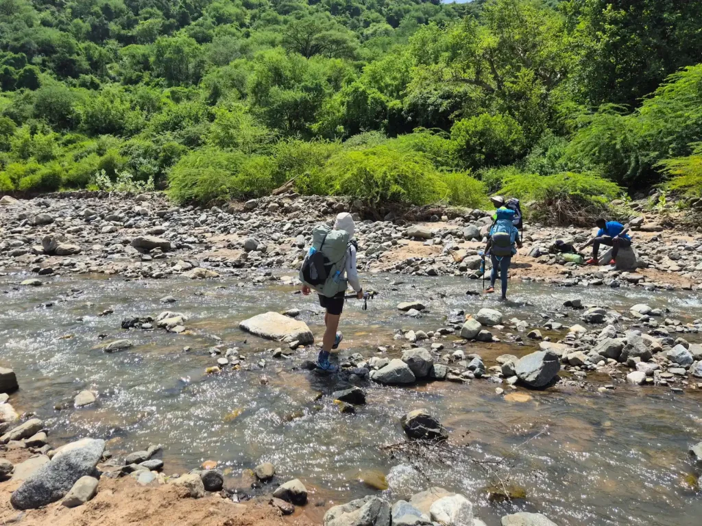
Psychological factors
Beyond navigation, factors like exposure, heights, narrow ridges, river crossings, or long stretches of isolation can also make a hike feel harder. These elements aren’t reflected in the numbers, but they influence how comfortable and confident you feel – and that affects perceived effort.
Hiking difficulty rating table
The table below shows the typical characteristics for each difficulty level. These aren’t strict rules; they’re guidelines that help position a hike on the scale.
| Difficulty level | Elevation gain (m) | Duration (hours) | Distance (km) | Average gradient | Terrain characteristics |
|---|---|---|---|---|---|
| Easy | 0–400 | 0–2 | 0–8 | <5% | Smooth, well-defined paths; flat or gently rolling terrain |
| Moderate | 400–800 | 2–4 | 8–14 | 4–6% | Mostly good paths with some uneven or rocky sections; occasional loose gravel or short climbs |
| Difficult | 800–1200 | 4–6 | 14–20 | 5–8% | Rocky, loose, or uneven terrain; steeper climbs or descents requiring careful footing |
| Strenuous | 1200–1600 | 6–8 | 20–25 | 6–10% | Sustained steep or rough terrain; loose rock, scree, narrow ridgelines, or light scrambling |
| Very Strenuous | 1600+ | 8+ | 25+ | >10% | Technical or high-mountain terrain; boulder fields, scree, or exposed and unstable ridgelines |
Adjusting for altitude
Altitude can shift a hike’s difficulty up by one or more levels. The table below shows how I adjust the overall rating based on the trail’s average altitude. These adjustments apply to the overall rating, not individual metrics, because altitude affects effort across all aspects of a hike.
| Sea-level rating | 2000–3500 m | 3500–4500 m | 4500–6000 m |
|---|---|---|---|
| Easy | Easy–Moderate | Moderate | Moderate–Difficult |
| Moderate | Moderate–Difficult | Difficult | Strenuous |
| Difficult | Difficult–Strenuous | Strenuous | Very Strenuous |
| Strenuous | Strenuous | Very Strenuous | Extremely Strenuous |
Real-life examples
These three examples show how the system works in practice and how different metrics interact to create the overall rating.
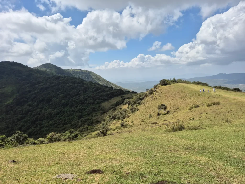
Ngong Hills, Kenya – Moderate
A classic out‑and‑back route with rolling hills, exposed ridgelines, and views over the Rift Valley.
- Elevation gain: 720 m → Moderate
- Duration: 2.5–5 hr → Moderate to Difficult
- Distance: 11.8 km → Moderate
- Average gradient: 6.1% → Difficult
- Terrain: rocky, uneven, wind-exposed ridgelines → Difficult
- Altitude: 2150–2450 m → No adjustment
Overall rating: Moderate
Most metrics sit in the Moderate range. The repeated climbs and exposure can make it feel harder, but the effort comes in short bursts rather than a sustained ascent.
Stellenboschberg, South Africa – Difficult
A steep, rocky climb above Stellenbosch with big views over the Cape Winelands.
- Elevation gain: 1050 m → Difficult
- Duration: 4–6 hr → Difficult
- Distance: 11.5 km → Moderate
- Average gradient: 9.1% → Strenuous
- Terrain: rocky paths, loose gravel, light scrambling → Difficult to Strenuous
- Altitude: below 2000 m → No adjustment
Overall rating: Difficult
The steep gradient and rocky terrain dominate the experience, but the relatively short distance keeps it from tipping into Strenuous.
Lake Ellis to Mintos, Mount Kenya – Strenuous
A high‑altitude approach to Mintos, often used as a basecamp before the summit attempt to Point Lenana.
- Elevation gain: 940 m → Difficult
- Duration: 4–7 hr → Difficult
- Distance: 8.1 km → Moderate
- Average gradient: 11.6% → Very Strenuous
- Terrain: rocky moorland, uneven paths, loose gravel → Difficult
- Sea-level rating: Difficult
- Altitude: 3440–4300 m → Adjust one level up
Overall rating: Strenuous
At sea level this hike would be Difficult, but altitude pushes it to Strenuous.
Final thoughts
This rating system is designed to be simple, clear, and useful. It blends objective trail stats with real-life experience to give a sense of how a hike feels.
Start with elevation gain. It’s the best single predictor of difficulty. Then look at terrain, distance, and altitude to get a more complete picture.
Duration is highly individual, so treat it as a rough guide rather than a precise measure. On this site, I share my own times – or those of the group I’m hiking with. Use them cautiously.